Drone-Assisted Marine Mammal Survey Market Size, Share & Growth Analysis, 2026-2034
Drone-Assisted Marine Mammal Survey Market Size, Share & Growth Analysis, 2026-2034
Segments - by Drone Type (Fixed-Wing, Rotary-Wing, Hybrid), by Application (Population Monitoring, Behavioral Studies, Habitat Assessment, Health Assessment, Others), by End-User (Research Institutes, Government Agencies, Conservation Organizations, Commercial Operators, Others), by Technology (Thermal Imaging, High-Resolution Imaging, LiDAR, GPS Tracking, Others)



Last Updated : Jun, 2026
| Report ID :AD-11776
| 4.9 Rating
| 65 Reviews
| 285 Pages
| Format :


Drone-Assisted Marine Mammal Survey Market: Key Numbers
The Drone-Assisted Marine Mammal Survey market was valued at USD 471 Million in 2025 and is projected to reach USD 1543 Million by 2034, a CAGR of 14.8%.
| Market size (2025) | USD 471 Million |
|---|---|
| Forecast (2034) | USD 1543 Million |
| CAGR (2026-2034) | 14.8% |
| Largest region | North America (USD 180 Million) |
| Segments covered | Drone Type, Application, End-User, Technology |
| Key companies | DJI Innovations, Parrot SA, AeroVironment Inc., Teledyne FLIR, Hexagon AB (Leica Geosystems) |
This report is updated with the latest market data and insights as of June 2026. Base year: 2025 | Forecast period: 2026-2034
Drone-Assisted Marine Mammal Survey Market Size and Growth Outlook
Growth Market Reports finds that the global drone-assisted marine mammal survey market size reached USD 471 million in 2025, with robust year-on-year growth driven by advancements in drone technology and increasing marine conservation initiatives worldwide. The market is expected to register a CAGR of 14.8% from 2026 to 2034, projecting the overall value to reach approximately USD 1,543 million by 2034. This remarkable growth trajectory is primarily attributed to the rising adoption of unmanned aerial vehicles (UAVs) for efficient, cost-effective, and minimally invasive marine mammal monitoring across the globe.

The primary growth factor propelling the drone-assisted marine mammal survey market is the escalating need for accurate, real-time data on marine mammal populations. Traditional survey methods, often reliant on manned aircraft or boats, are not only expensive but also pose potential risks to both animals and researchers. Drones equipped with advanced imaging and tracking technologies offer a non-intrusive alternative that can cover large oceanic expanses in shorter timeframes. This technological leap has dramatically improved the scope and precision of marine mammal studies, supporting conservation efforts and policy formulation across diverse jurisdictions. Additionally, the growing awareness around the impact of climate change and human activities on marine ecosystems is further accelerating the demand for innovative survey solutions.
Another significant driver is the surge in governmental and non-governmental funding for marine biodiversity research. Governments worldwide are increasingly mandating comprehensive environmental impact assessments, especially for coastal development and offshore resource exploration. In response, research institutes and conservation organizations are leveraging drone-assisted surveys to fulfill regulatory requirements and drive proactive conservation strategies. The ability of drones to access remote or hazardous marine environments, such as polar regions or areas with rough seas, is also expanding the operational boundaries of marine mammal research. These capabilities are particularly crucial for monitoring endangered species and understanding migration patterns, which are vital for effective marine spatial planning. Similar technological progress is being observed in adjacent fields such as drone-assisted reef fish population monitoring, where UAVs are now transforming underwater biodiversity assessment at scale.
The integration of cutting-edge technologies such as thermal imaging, high-resolution cameras, LiDAR, and GPS tracking into drones is revolutionizing data collection and analysis. These technological advancements enable researchers to detect and identify marine mammals with unprecedented accuracy, even under challenging weather or lighting conditions. Furthermore, real-time data transmission and AI-powered image processing are enhancing the speed and reliability of survey operations. As a result, the market is witnessing increased adoption across diverse applications, from population monitoring and behavioral studies to habitat and health assessments. The synergy between technology providers and end-users is fostering a dynamic ecosystem that continues to fuel the market's expansion.
In parallel with marine mammal surveys, the growth of UAV-based wetland biodiversity monitoring is transforming how researchers approach the study of wetland ecosystems. These surveys are crucial for understanding the complex interactions within wetlands, which are among the most productive ecosystems on the planet. By utilizing drones equipped with multispectral and thermal sensors, researchers can efficiently map and monitor wetland areas, assess vegetation health, and detect changes in water levels or quality. This technology is particularly valuable in remote or inaccessible wetlands, where traditional survey methods are challenging. As climate change and human activities continue to threaten wetland habitats, drone-assisted surveys provide a powerful tool for conservationists aiming to preserve biodiversity and ecosystem services.
From a regional perspective, North America currently dominates the drone-assisted marine mammal survey market, accounting for over 38% of the global share in 2025. This leadership is driven by strong investments in marine research, a well-established regulatory framework, and the presence of leading drone manufacturers and technology providers. Europe follows closely, bolstered by active marine conservation programs and collaborative research initiatives. The Asia Pacific region is emerging as a high-growth market, supported by increasing government focus on marine biodiversity and expanding coastal economies. Meanwhile, Latin America and the Middle East & Africa are gradually catching up, leveraging international partnerships and capacity-building efforts to enhance their marine monitoring capabilities.
Drone-Assisted Marine Mammal Survey Market by Drone Type
The drone-assisted marine mammal survey market is segmented by drone type into fixed-wing, rotary-wing, and hybrid drones, each offering distinct operational advantages. Fixed-wing drones are widely preferred for their extended flight endurance and ability to cover vast oceanic areas efficiently. These drones are particularly beneficial for large-scale population monitoring and migratory studies, where long-range surveillance is essential. Their aerodynamic design allows them to remain airborne for several hours, making them ideal for surveying remote or inaccessible marine habitats. However, their requirement for runway or catapult launch systems can limit deployment in some field conditions, prompting researchers to carefully assess operational trade-offs.

Rotary-wing drones, commonly known as multi-rotor UAVs, hold the largest market share in 2025 and have gained significant traction in applications requiring high maneuverability and precise hovering capabilities. These drones excel in close-range observations, behavioral studies, and detailed habitat assessments, where the ability to hover and change altitude rapidly is crucial. Their compact size and vertical take-off and landing (VTOL) capabilities make rotary-wing drones highly adaptable for deployment from boats, research vessels, or rugged coastal terrains. Despite their relatively shorter flight times compared to fixed-wing counterparts, ongoing advancements in battery technology and payload integration are steadily enhancing their operational efficiency and appeal. The broader application of rotary-wing platforms across ecological monitoring is also evident in drone-enabled wildlife survey solutions covering terrestrial and semi-aquatic species.
The emergence of hybrid drones is reshaping the landscape of marine mammal surveys by combining the strengths of both fixed-wing and rotary-wing platforms. Hybrid drones can take off and land vertically while transitioning to fixed-wing flight for extended endurance, offering unmatched versatility for diverse survey missions. This dual capability allows researchers to conduct long-range population monitoring as well as detailed site-specific studies within a single mission, optimizing resource utilization and data collection. As hybrid drone technology matures through 2026 and beyond, it is expected to capture a growing share of the market, particularly among organizations seeking flexible, all-in-one survey solutions.
Market trends indicate a growing preference for modular drone designs that support easy integration of advanced sensors and imaging systems. Manufacturers are increasingly focusing on enhancing drone reliability, payload capacity, and autonomous navigation features to meet the evolving needs of marine researchers. The competitive landscape is characterized by continuous innovation, with leading players investing in R&D to develop next-generation drones optimized for harsh marine environments. As regulatory frameworks for drone operations continue to evolve, especially in sensitive ecological zones, the adoption of compliant and environmentally responsible drone platforms is expected to rise significantly through the forecast period.
Drone-Assisted Marine Mammal Survey Market Report Scope
| Attributes | Details |
| Report Title | Drone-Assisted Marine Mammal Survey Market Research Report 2034 |
| By Drone Type | Fixed-Wing, Rotary-Wing, Hybrid |
| By Application | Population Monitoring, Behavioral Studies, Habitat Assessment, Health Assessment, Others |
| By End-User | Research Institutes, Government Agencies, Conservation Organizations, Commercial Operators, Others |
| By Technology | Thermal Imaging, High-Resolution Imaging, LiDAR, GPS Tracking, Others |
| Regions Covered | North America, Europe, APAC, Latin America, MEA |
| Base Year | 2025 |
| Historic Data | 2019-2024 |
| Forecast Period | 2026-2034 |
| Number of Pages | 285 |
| Number of Tables & Figures | 278 |
| Customization Available | Yes, the report can be customized as per your need. |
Drone-Assisted Marine Mammal Survey Market by Application
The application landscape of the drone-assisted marine mammal survey market is broad and multifaceted, encompassing population monitoring, behavioral studies, habitat assessment, health assessment, and other specialized research areas. Population monitoring remains the largest application segment, accounting for nearly 42% of the market share in 2025. Drones enable researchers to conduct systematic aerial surveys over expansive marine territories, capturing high-resolution imagery and video data that facilitate accurate population estimates. This capability is instrumental in tracking population trends, identifying critical habitats, and informing conservation policies, especially for endangered or migratory species.
Behavioral studies represent a rapidly growing application area, leveraging the unobtrusive nature of drones to observe marine mammals in their natural environment without causing disturbance. High-resolution imaging and video analytics allow researchers to document social interactions, feeding patterns, and responses to environmental changes with unprecedented detail. These insights are invaluable for understanding species-specific behaviors and assessing the impact of human activities, such as shipping traffic or offshore developments, on marine mammal well-being. The convergence of behavioral research with advanced whale tracking using aerial drones is opening new frontiers for longitudinal cetacean studies. As behavioral research becomes increasingly data-driven, the demand for advanced drone platforms capable of long-duration, real-time monitoring is expected to surge through 2034.
Habitat assessment is another critical application, focusing on the mapping and evaluation of marine mammal habitats to support ecosystem management and conservation planning. Drones equipped with LiDAR and multispectral sensors can generate detailed topographic and vegetation maps, enabling researchers to assess habitat quality, detect changes over time, and identify potential threats. These data-driven assessments are essential for designing effective marine protected areas, restoring degraded habitats, and mitigating the impacts of climate change on marine biodiversity. The integration of geospatial analytics and AI-powered image processing is further enhancing the precision and scalability of habitat surveys across both temperate and polar environments.
Health assessment applications are gaining momentum as drones facilitate the non-invasive collection of biological samples, such as blow exhalations or skin swabs, and enable remote visual health checks. Thermal imaging and high-resolution cameras can detect signs of illness, injury, or stress, supporting early intervention and targeted conservation actions. The ability to monitor health indicators at population and individual levels is particularly valuable in the context of emerging diseases and environmental stressors. As public and private sector stakeholders prioritize marine mammal health monitoring through the late 2020s, the adoption of drone-assisted health assessment tools is poised for significant growth.
Drone-Assisted Marine Mammal Survey Market by End-User
The end-user landscape for the drone-assisted marine mammal survey market is diverse, encompassing research institutes, government agencies, conservation organizations, commercial operators, and other stakeholders. Research institutes constitute the largest end-user segment, accounting for approximately 36% of market demand in 2025. These institutions leverage drone technology to advance scientific knowledge, conduct longitudinal studies, and publish peer-reviewed research that informs policy and conservation strategies. The availability of research grants and collaborative funding models is further driving the adoption of drones in academic and scientific settings.
Government agencies play a pivotal role in shaping the market, utilizing drone-assisted surveys to fulfill regulatory mandates, monitor protected areas, and enforce environmental compliance. National and regional authorities are increasingly integrating drone data into marine spatial planning, fisheries management, and emergency response frameworks. The ability to rapidly deploy drones for real-time monitoring and incident assessment is enhancing the effectiveness of government-led conservation programs. As regulatory frameworks evolve to accommodate expanded drone operations, public sector adoption is expected to accelerate, particularly in regions with extensive marine jurisdictions and active offshore energy sectors.
Conservation organizations are at the forefront of leveraging drone technology for advocacy, education, and direct conservation action. These organizations harness the power of drones to raise public awareness, engage local communities, and document the impact of conservation interventions. Drones enable cost-effective, scalable monitoring of critical habitats and species, supporting data-driven fundraising and policy advocacy efforts. Partnerships between conservation NGOs, technology providers, and academic institutions are fostering a collaborative ecosystem that drives innovation and knowledge sharing across the sector, mirroring collaborative models seen in drone-based Arctic wildlife monitoring programs targeting polar mammals and seabirds.
Commercial operators are emerging as key market participants, offering specialized drone survey services to research institutions, government agencies, and private clients. These operators provide end-to-end solutions, including drone deployment, data collection, analytics, and reporting, enabling clients to access cutting-edge technology without significant capital investment. The rise of commercial drone service providers is democratizing access to marine mammal survey capabilities, particularly for smaller organizations or projects with limited resources. As the market matures through 2034, commercial operators are expected to play an increasingly prominent role in scaling up drone-assisted survey operations worldwide.
Drone-Assisted Marine Mammal Survey Market by Technology
Technological innovation lies at the heart of the drone-assisted marine mammal survey market, with key advancements in thermal imaging, high-resolution imaging, LiDAR, GPS tracking, and other sensor technologies. Thermal imaging has become an indispensable tool for detecting marine mammals, particularly in low-visibility conditions or during nocturnal surveys. By capturing heat signatures, thermal cameras enable researchers to identify and count animals that may be hidden beneath the water surface or camouflaged against complex backgrounds. This capability is crucial for monitoring elusive or cryptic species and ensuring comprehensive survey coverage in diverse marine environments.
High-resolution imaging is driving significant improvements in data quality and analytical accuracy. Drones equipped with advanced cameras can capture detailed aerial photographs and videos, facilitating species identification, behavioral analysis, and habitat mapping. The integration of AI-powered image recognition algorithms is streamlining data processing, enabling rapid extraction of actionable insights from large datasets. High-resolution imaging is particularly valuable for documenting rare or transient events, such as calving, predation, or social interactions, that are difficult to observe through traditional survey methods.
LiDAR (Light Detection and Ranging) technology is gaining traction in habitat assessment and topographic mapping applications. LiDAR sensors emit laser pulses to generate precise 3D models of marine and coastal environments, supporting the identification of habitat features, bathymetric mapping, and change detection over time. The ability to integrate LiDAR data with multispectral and RGB imagery is enhancing the depth and richness of marine mammal habitat studies. As LiDAR technology becomes more compact and cost-effective entering the 2026-2034 forecast window, its adoption in drone-assisted surveys is expected to increase substantially, particularly for large-scale or complex research projects.
GPS tracking systems are essential for accurate geolocation and spatial analysis of survey data. Drones equipped with high-precision GPS modules can autonomously navigate pre-defined flight paths, ensuring systematic coverage and repeatability of survey missions. GPS data is also critical for integrating drone-derived observations with other geospatial datasets, such as satellite imagery or vessel tracking systems. This interoperability supports comprehensive ecosystem assessments and facilitates cross-disciplinary research collaborations. As drone technology continues to evolve, the integration of real-time data transmission, cloud-based analytics, and remote sensing platforms is set to further enhance the capabilities and impact of marine mammal surveys globally.
Drone-Assisted Marine Mammal Survey Market Opportunities and Threats
The drone-assisted marine mammal survey market presents a wealth of opportunities for technology providers, researchers, and conservation stakeholders through the 2026-2034 forecast period. One of the most promising avenues is the integration of artificial intelligence and machine learning algorithms into drone platforms, enabling automated species identification, behavior classification, and anomaly detection. These advancements have the potential to significantly reduce data processing time, enhance survey accuracy, and support real-time decision-making in the field. Additionally, the expansion of cloud-based data management and analytics platforms is facilitating seamless collaboration and data sharing among international research teams, accelerating scientific discovery and conservation impact. The ongoing miniaturization of sensors and improvement in battery technology are also opening up new possibilities for long-duration, autonomous survey missions in remote or challenging marine environments.
Another key opportunity lies in the development of tailored drone solutions for specific marine mammal species or research objectives. Customizable payloads, modular sensor configurations, and adaptive flight planning algorithms are enabling researchers to address unique survey requirements, from tracking migratory whales to monitoring small, coastal populations of dolphins or seals. The increasing availability of affordable, off-the-shelf drone platforms is democratizing access to advanced survey capabilities, empowering smaller organizations and citizen science initiatives to contribute valuable data to global marine mammal research. The growth of complementary survey markets, including sea turtle nest monitoring via drone, underscores the broader expansion of UAV-based ecological research, which is creating shared technology infrastructure and reducing costs across disciplines. As regulatory frameworks become more supportive of drone operations in marine environments, the market is poised for further expansion, driven by cross-sector partnerships and public-private collaborations.
Despite these opportunities, the market faces several restraining factors that could impede growth. Regulatory uncertainty and operational restrictions on drone flights over marine protected areas or sensitive wildlife habitats remain a significant challenge in many regions. Concerns about potential disturbance to marine mammals, data privacy, and airspace safety are prompting authorities to implement stringent permitting and oversight requirements. Additionally, the high upfront costs of advanced drone platforms and specialized sensors may limit adoption among resource-constrained organizations. Adverse weather conditions in polar and offshore environments present additional operational hurdles. Addressing these challenges will require ongoing dialogue between industry stakeholders, regulators, and conservation advocates to ensure that drone-assisted surveys are conducted responsibly and sustainably.
Drone-Assisted Marine Mammal Survey Market Size by Region
Regionally, North America leads the drone-assisted marine mammal survey market, with a market size of USD 180 million in 2025. This dominance is underpinned by a strong ecosystem of marine research institutions, proactive environmental policies, and a mature drone technology sector. The United States and Canada are at the forefront of deploying drone-assisted surveys for marine mammal monitoring, supported by robust government funding and strategic collaborations between academia, industry, and conservation organizations. The region's extensive coastline and diverse marine habitats provide ample opportunities for large-scale survey projects, driving continued investment in advanced drone platforms and data analytics.

Europe represents the second-largest regional market, valued at USD 123 million in 2025, with a projected CAGR of 15.2% through 2034. The region's leadership in marine conservation and biodiversity research is fostering widespread adoption of drone technology for population monitoring, habitat assessment, and policy support. Key countries such as the United Kingdom, Norway, and Germany are investing in cutting-edge drone solutions to address challenges related to marine spatial planning, fisheries management, and climate adaptation. The European Union's emphasis on cross-border research collaboration and data standardization is further enhancing the scalability and impact of drone-assisted marine mammal surveys across the continent. Emerging polar survey capabilities are additionally being shared with programs such as drone-assisted ice thickness measurement in Arctic and sub-Arctic waters, creating synergies for marine mammal monitoring in high-latitude environments.
Asia Pacific is emerging as a high-growth market, with a 2025 market size of USD 87 million. The region's expanding coastal economies, increasing government attention to marine biodiversity, and growing participation in international conservation initiatives are driving demand for drone-assisted survey solutions. Countries such as Australia, Japan, and China are investing in research infrastructure and capacity-building to enhance their marine monitoring capabilities. Meanwhile, Latin America and Middle East & Africa collectively account for USD 81 million of the global market in 2025, with growth supported by targeted conservation projects, international funding, and technology transfer initiatives. As regional markets mature and regulatory barriers are addressed through the late 2020s and early 2030s, the global adoption of drone-assisted marine mammal surveys is expected to accelerate further.
Drone-Assisted Marine Mammal Survey Market Competitive Landscape
The competitive landscape of the drone-assisted marine mammal survey market is characterized by a dynamic mix of established technology providers, specialized drone manufacturers, and innovative start-ups. Leading companies are investing heavily in research and development to enhance drone performance, sensor integration, and data analytics capabilities. The market is witnessing a trend toward strategic partnerships and collaborations, as technology providers join forces with research institutions, conservation organizations, and government agencies to co-develop tailored survey solutions. Intellectual property protection, regulatory compliance, and environmental stewardship are emerging as key differentiators in a market that values both technological excellence and responsible operations.
Product innovation is a primary focus area for market leaders, with ongoing efforts to develop drones that are more reliable, user-friendly, and adaptable to diverse marine environments. Companies are prioritizing modular designs that support easy customization of payloads and sensors, enabling researchers to address a wide range of survey objectives. The integration of AI-powered image processing, real-time data transmission, and cloud-based analytics is enhancing the value proposition of drone-assisted survey solutions, positioning leading vendors at the forefront of digital transformation in marine research. As competition intensifies through the 2026-2034 period, companies are also expanding their service offerings to include training, technical support, and data management services, fostering long-term client relationships and recurring revenue streams.
The market is also witnessing the emergence of specialized service providers that offer turnkey drone survey solutions to research institutes, government agencies, and conservation organizations. These companies leverage their expertise in drone operations, data analytics, and regulatory compliance to deliver comprehensive, end-to-end services that reduce the operational burden on clients. The rise of commercial drone service providers is democratizing access to advanced survey capabilities, enabling smaller organizations and projects to benefit from state-of-the-art technology without significant capital investment. As the market matures, service differentiation, client-centric solutions, and operational excellence will be critical to sustaining competitive advantage.
Some of the major companies operating in the drone-assisted marine mammal survey market include DJI Innovations, Parrot SA, AeroVironment Inc., Teledyne FLIR, Hexagon AB (Leica Geosystems), AgEagle Aerial Systems (senseFly), Delair, Quantum Systems, Wildlife Drones, Oceans Unmanned, Blue Ocean Monitoring, Open Ocean Robotics, Airborne Technologies, Sky-Futures, and Ocean Imaging. DJI Innovations, a global leader in drone manufacturing, offers a wide range of UAV platforms equipped with advanced imaging and navigation systems widely used in marine research applications. Parrot SA and AgEagle Aerial Systems (senseFly) are recognized for their fixed-wing and hybrid drone solutions, catering to large-scale population monitoring and habitat assessment projects. Delair and Quantum Systems are at the forefront of integrating AI and cloud-based analytics into their survey platforms, enhancing data processing and decision support capabilities. Wildlife Drones and Oceans Unmanned are pioneering the application of drone technology in marine mammal health assessments and behavioral studies, leveraging interdisciplinary expertise to drive innovation and impact across the sector.
These companies are continually expanding their product portfolios and service offerings to address the evolving needs of marine researchers and conservationists. Strategic investments in R&D, international partnerships, and capacity-building initiatives are enabling leading vendors to maintain their competitive edge and capitalize on emerging market opportunities. As the global focus on marine biodiversity and ecosystem health intensifies through the 2030s, the role of drone-assisted surveys in advancing scientific knowledge and conservation outcomes is set to grow, positioning market leaders for sustained success in the years ahead.
Top Companies in the Drone-Assisted Marine Mammal Survey Market
- DJI Innovations
- Parrot SA
- AeroVironment Inc.
- Teledyne FLIR
- Hexagon AB (Leica Geosystems)
- AgEagle Aerial Systems (senseFly)
- Delair
- Quantum Systems
- Wildlife Drones
- Oceans Unmanned
- Blue Ocean Monitoring
- Open Ocean Robotics
- Airborne Technologies
- Sky-Futures
- Ocean Imaging
Segments
The Drone-Assisted Marine Mammal Survey market has been segmented on the basis of
Drone Type
- Fixed-Wing
- Rotary-Wing
- Hybrid
Application
- Population Monitoring
- Behavioral Studies
- Habitat Assessment
- Health Assessment
- Others
End-User
- Research Institutes
- Government Agencies
- Conservation Organizations
- Commercial Operators
- Others
Technology
- Thermal Imaging
- High-Resolution Imaging
- LiDAR
- GPS Tracking
- Others
Frequently Asked Questions
Drones are fundamentally improving marine mammal conservation by enabling non-invasive, cost-effective, and scalable surveys across vast and previously inaccessible oceanic and coastal areas. They allow researchers to monitor population sizes, document behavioral patterns, assess habitat quality, and collect biological samples such as blow exhalates for health analysis, all without causing significant disturbance. The integration of AI analytics is enabling faster, more accurate identification and classification of species and individuals, accelerating scientific discovery and supporting evidence-based conservation policy worldwide.
Leading companies in the market include DJI Innovations, Parrot SA, AeroVironment Inc., Teledyne FLIR, Hexagon AB (Leica Geosystems), AgEagle Aerial Systems (senseFly), Delair, Quantum Systems, Wildlife Drones, Oceans Unmanned, Blue Ocean Monitoring, Open Ocean Robotics, Airborne Technologies, Sky-Futures, and Ocean Imaging. These players compete on the basis of drone performance, sensor integration, data analytics capabilities, and the breadth of end-to-end service offerings.
Key challenges include regulatory restrictions on drone operations over marine protected areas and sensitive wildlife habitats, concerns about potential acoustic and visual disturbance to marine mammals, high capital costs for advanced sensor-equipped platforms, and the need for skilled operators capable of handling complex data workflows. Adverse weather conditions in polar and offshore environments, limited communication infrastructure in remote survey areas, and evolving airspace regulations also present ongoing operational challenges.
The market is being transformed by AI-powered image recognition enabling automated species identification, miniaturized LiDAR sensors for precise 3D habitat mapping, advanced thermal cameras for nocturnal and low-visibility surveys, and high-resolution multispectral imaging for health and behavioral analysis. Real-time data transmission, edge computing, and cloud-based analytics platforms are further accelerating the speed and accuracy of survey operations, while improvements in battery energy density are extending drone endurance for offshore missions.
North America leads the global market with approximately 38.2% of revenue share in 2025, supported by robust marine research infrastructure, strong government funding, and a mature drone technology ecosystem. Europe holds the second-largest share at 26.1%, driven by active marine conservation programs and EU-funded research initiatives. Asia Pacific is the fastest-growing regional market at 18.4% share, with Australia, Japan, and China making significant investments in marine monitoring capabilities.
Research institutes are the largest end-user segment, accounting for approximately 36% of market demand in 2025, driven by academic and scientific research programs. Government agencies represent the second-largest segment, leveraging drone surveys for regulatory compliance, protected area management, and fisheries oversight. Conservation organizations, commercial drone service operators, and private sector clients in the energy and maritime industries round out the end-user landscape.
Population monitoring is the dominant application, representing nearly 42% of market demand in 2025, followed by behavioral studies, habitat assessment, and health assessment. Other specialized applications include migration tracking, bioacoustic research support, and environmental impact assessment for offshore infrastructure projects. Each application segment is benefiting from improvements in sensor technology, AI analytics, and autonomous flight capabilities.
Rotary-wing drones currently hold the largest share at approximately 42% of the market in 2025, favored for their hovering capability, VTOL operation, and suitability for close-range behavioral and health studies. Fixed-wing drones account for about 38.5% of the market, preferred for long-endurance, large-area population monitoring missions. Hybrid drones, combining the strengths of both platforms, represent the fastest-growing segment at around 19.5% and are gaining traction for their mission versatility.
Key growth drivers include rising governmental and NGO funding for marine biodiversity research, increasing regulatory requirements for environmental impact assessments related to coastal development and offshore energy projects, advances in AI-powered image analysis, and the cost and safety advantages of drones over manned aircraft or vessel-based surveys. Growing concern over climate change impacts on marine ecosystems is also accelerating demand for precise, real-time monitoring tools.
The global drone-assisted marine mammal survey market reached USD 471 million in 2025 and is projected to grow at a CAGR of 14.8% from 2026 to 2034, reaching approximately USD 1,543 million by 2034. This strong growth is driven by rapid adoption of UAV technology, expanding marine conservation mandates, and continuous improvements in drone payload capabilities.
Table Of Content
Chapter 1 Executive SummaryChapter 2 Assumptions and Acronyms Used
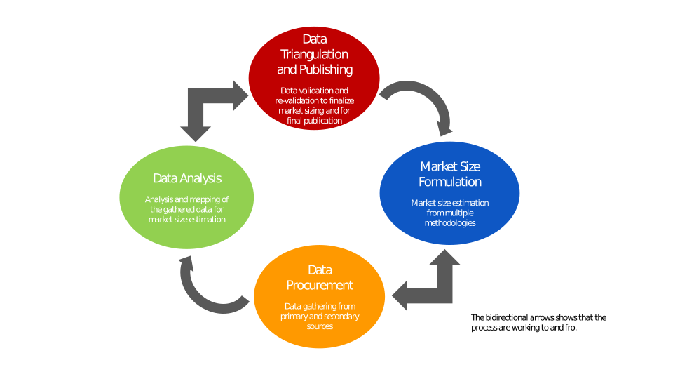
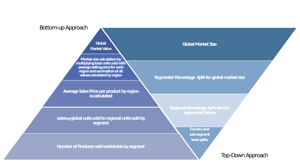
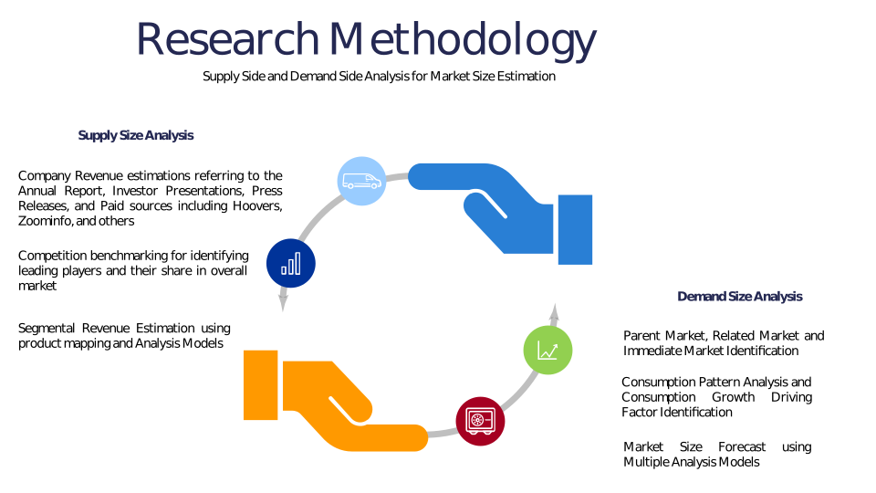
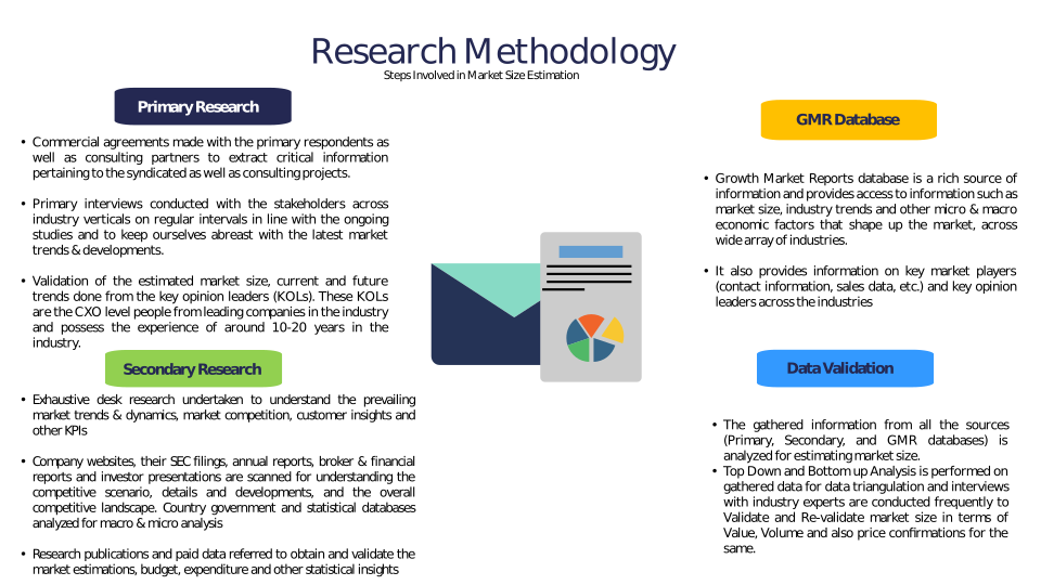
Chapter 3 Research Methodology
Chapter 4 Drone-Assisted Marine Mammal Survey Market Overview
4.1 Introduction
4.1.1 Market Taxonomy
4.1.2 Market Definition
4.1.3 Macro-Economic Factors Impacting the Market Growth
4.2 Drone-Assisted Marine Mammal Survey Market Dynamics
4.2.1 Market Drivers
4.2.2 Market Restraints
4.2.3 Market Opportunity
4.3 Drone-Assisted Marine Mammal Survey Market - Supply Chain Analysis
4.3.1 List of Key Suppliers
4.3.2 List of Key Distributors
4.3.3 List of Key Consumers
4.4 Key Forces Shaping the Drone-Assisted Marine Mammal Survey Market
4.4.1 Bargaining Power of Suppliers
4.4.2 Bargaining Power of Buyers
4.4.3 Threat of Substitution
4.4.4 Threat of New Entrants
4.4.5 Competitive Rivalry
4.5 Global Drone-Assisted Marine Mammal Survey Market Size & Forecast, 2023-2032
4.5.1 Drone-Assisted Marine Mammal Survey Market Size and Y-o-Y Growth
4.5.2 Drone-Assisted Marine Mammal Survey Market Absolute $ Opportunity
Chapter 5 Global Drone-Assisted Marine Mammal Survey Market Analysis and Forecast By Drone Type
5.1 Introduction
5.1.1 Key Market Trends & Growth Opportunities By Drone Type
5.1.2 Basis Point Share (BPS) Analysis By Drone Type
5.1.3 Absolute $ Opportunity Assessment By Drone Type
5.2 Drone-Assisted Marine Mammal Survey Market Size Forecast By Drone Type
5.2.1 Fixed-Wing
5.2.2 Rotary-Wing
5.2.3 Hybrid
5.3 Market Attractiveness Analysis By Drone Type
Chapter 6 Global Drone-Assisted Marine Mammal Survey Market Analysis and Forecast By Application
6.1 Introduction
6.1.1 Key Market Trends & Growth Opportunities By Application
6.1.2 Basis Point Share (BPS) Analysis By Application
6.1.3 Absolute $ Opportunity Assessment By Application
6.2 Drone-Assisted Marine Mammal Survey Market Size Forecast By Application
6.2.1 Population Monitoring
6.2.2 Behavioral Studies
6.2.3 Habitat Assessment
6.2.4 Health Assessment
6.2.5 Others
6.3 Market Attractiveness Analysis By Application
Chapter 7 Global Drone-Assisted Marine Mammal Survey Market Analysis and Forecast By End-User
7.1 Introduction
7.1.1 Key Market Trends & Growth Opportunities By End-User
7.1.2 Basis Point Share (BPS) Analysis By End-User
7.1.3 Absolute $ Opportunity Assessment By End-User
7.2 Drone-Assisted Marine Mammal Survey Market Size Forecast By End-User
7.2.1 Research Institutes
7.2.2 Government Agencies
7.2.3 Conservation Organizations
7.2.4 Commercial Operators
7.2.5 Others
7.3 Market Attractiveness Analysis By End-User
Chapter 8 Global Drone-Assisted Marine Mammal Survey Market Analysis and Forecast By Technology
8.1 Introduction
8.1.1 Key Market Trends & Growth Opportunities By Technology
8.1.2 Basis Point Share (BPS) Analysis By Technology
8.1.3 Absolute $ Opportunity Assessment By Technology
8.2 Drone-Assisted Marine Mammal Survey Market Size Forecast By Technology
8.2.1 Thermal Imaging
8.2.2 High-Resolution Imaging
8.2.3 LiDAR
8.2.4 GPS Tracking
8.2.5 Others
8.3 Market Attractiveness Analysis By Technology
Chapter 9 Global Drone-Assisted Marine Mammal Survey Market Analysis and Forecast by Region
9.1 Introduction
9.1.1 Key Market Trends & Growth Opportunities By Region
9.1.2 Basis Point Share (BPS) Analysis By Region
9.1.3 Absolute $ Opportunity Assessment By Region
9.2 Drone-Assisted Marine Mammal Survey Market Size Forecast By Region
9.2.1 North America
9.2.2 Europe
9.2.3 Asia Pacific
9.2.4 Latin America
9.2.5 Middle East & Africa (MEA)
9.3 Market Attractiveness Analysis By Region
Chapter 10 Coronavirus Disease (COVID-19) Impact
10.1 Introduction
10.2 Current & Future Impact Analysis
10.3 Economic Impact Analysis
10.4 Government Policies
10.5 Investment Scenario
Chapter 11 North America Drone-Assisted Marine Mammal Survey Analysis and Forecast
11.1 Introduction
11.2 North America Drone-Assisted Marine Mammal Survey Market Size Forecast by Country
11.2.1 U.S.
11.2.2 Canada
11.3 Basis Point Share (BPS) Analysis by Country
11.4 Absolute $ Opportunity Assessment by Country
11.5 Market Attractiveness Analysis by Country
11.6 North America Drone-Assisted Marine Mammal Survey Market Size Forecast By Drone Type
11.6.1 Fixed-Wing
11.6.2 Rotary-Wing
11.6.3 Hybrid
11.7 Basis Point Share (BPS) Analysis By Drone Type
11.8 Absolute $ Opportunity Assessment By Drone Type
11.9 Market Attractiveness Analysis By Drone Type
11.10 North America Drone-Assisted Marine Mammal Survey Market Size Forecast By Application
11.10.1 Population Monitoring
11.10.2 Behavioral Studies
11.10.3 Habitat Assessment
11.10.4 Health Assessment
11.10.5 Others
11.11 Basis Point Share (BPS) Analysis By Application
11.12 Absolute $ Opportunity Assessment By Application
11.13 Market Attractiveness Analysis By Application
11.14 North America Drone-Assisted Marine Mammal Survey Market Size Forecast By End-User
11.14.1 Research Institutes
11.14.2 Government Agencies
11.14.3 Conservation Organizations
11.14.4 Commercial Operators
11.14.5 Others
11.15 Basis Point Share (BPS) Analysis By End-User
11.16 Absolute $ Opportunity Assessment By End-User
11.17 Market Attractiveness Analysis By End-User
11.18 North America Drone-Assisted Marine Mammal Survey Market Size Forecast By Technology
11.18.1 Thermal Imaging
11.18.2 High-Resolution Imaging
11.18.3 LiDAR
11.18.4 GPS Tracking
11.18.5 Others
11.19 Basis Point Share (BPS) Analysis By Technology
11.20 Absolute $ Opportunity Assessment By Technology
11.21 Market Attractiveness Analysis By Technology
Chapter 12 Europe Drone-Assisted Marine Mammal Survey Analysis and Forecast
12.1 Introduction
12.2 Europe Drone-Assisted Marine Mammal Survey Market Size Forecast by Country
12.2.1 Germany
12.2.2 France
12.2.3 Italy
12.2.4 U.K.
12.2.5 Spain
12.2.6 Russia
12.2.7 Rest of Europe
12.3 Basis Point Share (BPS) Analysis by Country
12.4 Absolute $ Opportunity Assessment by Country
12.5 Market Attractiveness Analysis by Country
12.6 Europe Drone-Assisted Marine Mammal Survey Market Size Forecast By Drone Type
12.6.1 Fixed-Wing
12.6.2 Rotary-Wing
12.6.3 Hybrid
12.7 Basis Point Share (BPS) Analysis By Drone Type
12.8 Absolute $ Opportunity Assessment By Drone Type
12.9 Market Attractiveness Analysis By Drone Type
12.10 Europe Drone-Assisted Marine Mammal Survey Market Size Forecast By Application
12.10.1 Population Monitoring
12.10.2 Behavioral Studies
12.10.3 Habitat Assessment
12.10.4 Health Assessment
12.10.5 Others
12.11 Basis Point Share (BPS) Analysis By Application
12.12 Absolute $ Opportunity Assessment By Application
12.13 Market Attractiveness Analysis By Application
12.14 Europe Drone-Assisted Marine Mammal Survey Market Size Forecast By End-User
12.14.1 Research Institutes
12.14.2 Government Agencies
12.14.3 Conservation Organizations
12.14.4 Commercial Operators
12.14.5 Others
12.15 Basis Point Share (BPS) Analysis By End-User
12.16 Absolute $ Opportunity Assessment By End-User
12.17 Market Attractiveness Analysis By End-User
12.18 Europe Drone-Assisted Marine Mammal Survey Market Size Forecast By Technology
12.18.1 Thermal Imaging
12.18.2 High-Resolution Imaging
12.18.3 LiDAR
12.18.4 GPS Tracking
12.18.5 Others
12.19 Basis Point Share (BPS) Analysis By Technology
12.20 Absolute $ Opportunity Assessment By Technology
12.21 Market Attractiveness Analysis By Technology
Chapter 13 Asia Pacific Drone-Assisted Marine Mammal Survey Analysis and Forecast
13.1 Introduction
13.2 Asia Pacific Drone-Assisted Marine Mammal Survey Market Size Forecast by Country
13.2.1 China
13.2.2 Japan
13.2.3 South Korea
13.2.4 India
13.2.5 Australia
13.2.6 South East Asia (SEA)
13.2.7 Rest of Asia Pacific (APAC)
13.3 Basis Point Share (BPS) Analysis by Country
13.4 Absolute $ Opportunity Assessment by Country
13.5 Market Attractiveness Analysis by Country
13.6 Asia Pacific Drone-Assisted Marine Mammal Survey Market Size Forecast By Drone Type
13.6.1 Fixed-Wing
13.6.2 Rotary-Wing
13.6.3 Hybrid
13.7 Basis Point Share (BPS) Analysis By Drone Type
13.8 Absolute $ Opportunity Assessment By Drone Type
13.9 Market Attractiveness Analysis By Drone Type
13.10 Asia Pacific Drone-Assisted Marine Mammal Survey Market Size Forecast By Application
13.10.1 Population Monitoring
13.10.2 Behavioral Studies
13.10.3 Habitat Assessment
13.10.4 Health Assessment
13.10.5 Others
13.11 Basis Point Share (BPS) Analysis By Application
13.12 Absolute $ Opportunity Assessment By Application
13.13 Market Attractiveness Analysis By Application
13.14 Asia Pacific Drone-Assisted Marine Mammal Survey Market Size Forecast By End-User
13.14.1 Research Institutes
13.14.2 Government Agencies
13.14.3 Conservation Organizations
13.14.4 Commercial Operators
13.14.5 Others
13.15 Basis Point Share (BPS) Analysis By End-User
13.16 Absolute $ Opportunity Assessment By End-User
13.17 Market Attractiveness Analysis By End-User
13.18 Asia Pacific Drone-Assisted Marine Mammal Survey Market Size Forecast By Technology
13.18.1 Thermal Imaging
13.18.2 High-Resolution Imaging
13.18.3 LiDAR
13.18.4 GPS Tracking
13.18.5 Others
13.19 Basis Point Share (BPS) Analysis By Technology
13.20 Absolute $ Opportunity Assessment By Technology
13.21 Market Attractiveness Analysis By Technology
Chapter 14 Latin America Drone-Assisted Marine Mammal Survey Analysis and Forecast
14.1 Introduction
14.2 Latin America Drone-Assisted Marine Mammal Survey Market Size Forecast by Country
14.2.1 Brazil
14.2.2 Mexico
14.2.3 Rest of Latin America (LATAM)
14.3 Basis Point Share (BPS) Analysis by Country
14.4 Absolute $ Opportunity Assessment by Country
14.5 Market Attractiveness Analysis by Country
14.6 Latin America Drone-Assisted Marine Mammal Survey Market Size Forecast By Drone Type
14.6.1 Fixed-Wing
14.6.2 Rotary-Wing
14.6.3 Hybrid
14.7 Basis Point Share (BPS) Analysis By Drone Type
14.8 Absolute $ Opportunity Assessment By Drone Type
14.9 Market Attractiveness Analysis By Drone Type
14.10 Latin America Drone-Assisted Marine Mammal Survey Market Size Forecast By Application
14.10.1 Population Monitoring
14.10.2 Behavioral Studies
14.10.3 Habitat Assessment
14.10.4 Health Assessment
14.10.5 Others
14.11 Basis Point Share (BPS) Analysis By Application
14.12 Absolute $ Opportunity Assessment By Application
14.13 Market Attractiveness Analysis By Application
14.14 Latin America Drone-Assisted Marine Mammal Survey Market Size Forecast By End-User
14.14.1 Research Institutes
14.14.2 Government Agencies
14.14.3 Conservation Organizations
14.14.4 Commercial Operators
14.14.5 Others
14.15 Basis Point Share (BPS) Analysis By End-User
14.16 Absolute $ Opportunity Assessment By End-User
14.17 Market Attractiveness Analysis By End-User
14.18 Latin America Drone-Assisted Marine Mammal Survey Market Size Forecast By Technology
14.18.1 Thermal Imaging
14.18.2 High-Resolution Imaging
14.18.3 LiDAR
14.18.4 GPS Tracking
14.18.5 Others
14.19 Basis Point Share (BPS) Analysis By Technology
14.20 Absolute $ Opportunity Assessment By Technology
14.21 Market Attractiveness Analysis By Technology
Chapter 15 Middle East & Africa (MEA) Drone-Assisted Marine Mammal Survey Analysis and Forecast
15.1 Introduction
15.2 Middle East & Africa (MEA) Drone-Assisted Marine Mammal Survey Market Size Forecast by Country
15.2.1 Saudi Arabia
15.2.2 South Africa
15.2.3 UAE
15.2.4 Rest of Middle East & Africa (MEA)
15.3 Basis Point Share (BPS) Analysis by Country
15.4 Absolute $ Opportunity Assessment by Country
15.5 Market Attractiveness Analysis by Country
15.6 Middle East & Africa (MEA) Drone-Assisted Marine Mammal Survey Market Size Forecast By Drone Type
15.6.1 Fixed-Wing
15.6.2 Rotary-Wing
15.6.3 Hybrid
15.7 Basis Point Share (BPS) Analysis By Drone Type
15.8 Absolute $ Opportunity Assessment By Drone Type
15.9 Market Attractiveness Analysis By Drone Type
15.10 Middle East & Africa (MEA) Drone-Assisted Marine Mammal Survey Market Size Forecast By Application
15.10.1 Population Monitoring
15.10.2 Behavioral Studies
15.10.3 Habitat Assessment
15.10.4 Health Assessment
15.10.5 Others
15.11 Basis Point Share (BPS) Analysis By Application
15.12 Absolute $ Opportunity Assessment By Application
15.13 Market Attractiveness Analysis By Application
15.14 Middle East & Africa (MEA) Drone-Assisted Marine Mammal Survey Market Size Forecast By End-User
15.14.1 Research Institutes
15.14.2 Government Agencies
15.14.3 Conservation Organizations
15.14.4 Commercial Operators
15.14.5 Others
15.15 Basis Point Share (BPS) Analysis By End-User
15.16 Absolute $ Opportunity Assessment By End-User
15.17 Market Attractiveness Analysis By End-User
15.18 Middle East & Africa (MEA) Drone-Assisted Marine Mammal Survey Market Size Forecast By Technology
15.18.1 Thermal Imaging
15.18.2 High-Resolution Imaging
15.18.3 LiDAR
15.18.4 GPS Tracking
15.18.5 Others
15.19 Basis Point Share (BPS) Analysis By Technology
15.20 Absolute $ Opportunity Assessment By Technology
15.21 Market Attractiveness Analysis By Technology
Chapter 16 Competition Landscape
16.1 Drone-Assisted Marine Mammal Survey Market: Competitive Dashboard
16.2 Global Drone-Assisted Marine Mammal Survey Market: Market Share Analysis, 2023
16.3 Company Profiles (Details – Overview, Financials, Developments, Strategy)
16.3.1 DJI Innovations
16.3.2 Parrot SA
16.3.3 AeroVironment Inc.
16.3.4 Teledyne FLIR
16.3.5 Hexagon AB (Leica Geosystems)
16.3.6 AgEagle Aerial Systems (senseFly)
16.3.7 Delair
16.3.8 Quantum Systems
16.3.9 Wildlife Drones
16.3.10 Oceans Unmanned
16.3.11 Blue Ocean Monitoring
16.3.12 Open Ocean Robotics
16.3.13 Airborne Technologies
16.3.14 Sky-Futures
16.3.15 Ocean Imaging
Methodology
Related Reports
Some other reports from this category!


Our Clients