Drone-Assisted Forest Moisture Content Mapping Market Size, Share & Growth Analysis, 2026-2034
Drone-Assisted Forest Moisture Content Mapping Market Size, Share & Growth Analysis, 2026-2034
Segments - by Technology (Multispectral Imaging, Thermal Imaging, LiDAR, RGB Imaging, Others), by Application (Forest Health Monitoring, Fire Risk Assessment, Precision Forestry, Environmental Research, Others), by End-User (Government & Forestry Agencies, Environmental Organizations, Research Institutes, Commercial Forestry, Others), by Platform (Fixed-Wing Drones, Rotary-Wing Drones, Hybrid Drones)



Last Updated : Jun, 2026
| Report ID :AD-11796
| 4.6 Rating
| 67 Reviews
| 252 Pages
| Format :


Drone-Assisted Forest Moisture Content Mapping Market: Key Numbers
The Drone-Assisted Forest Moisture Content Mapping market was valued at USD 1.32 Billion in 2025 and is projected to reach USD 5.18 Billion by 2034, a CAGR of 17.8%.
| Market size (2025) | USD 1.32 Billion |
|---|---|
| Forecast (2034) | USD 5.18 Billion |
| CAGR (2026-2034) | 17.8% |
| Largest region | North America |
| Segments covered | Technology, Application, End-User, Platform |
| Key companies | DJI Technology, Parrot Drones, AgEagle Aerial Systems, Delair, Teledyne FLIR |
This report is updated with the latest market data and insights as of June 2026. Base year: 2025 | Forecast period: 2026-2034
Drone-Assisted Forest Moisture Content Mapping Market Size and Growth Outlook
Growth Market Reports finds that the global drone-assisted forest moisture content mapping market size in 2025 is valued at USD 1.32 billion. The market is demonstrating robust momentum, supported by a CAGR of 17.8% from 2026 to 2034. By the end of 2034, the market is forecasted to reach USD 5.18 billion, reflecting significant expansion driven by technological advancements and escalating environmental concerns. The primary growth factor propelling this market is the urgent need for precise, real-time forest moisture data to support wildfire prevention, sustainable forestry, and climate resilience initiatives worldwide.

One of the core drivers of the drone-assisted forest moisture content mapping market is the escalating frequency and intensity of wildfires globally. As climate change accelerates, forested regions across continents are experiencing unprecedented droughts and heatwaves that heighten the risk of catastrophic fires. Accurate mapping of forest moisture content, enabled by drones equipped with advanced sensors, has become indispensable for early detection and risk mitigation. Governments and forestry agencies are investing heavily in drone technology to facilitate proactive forest management, reduce emergency response times, and minimize ecological and economic losses. This intensified focus on wildfire prevention and mitigation is directly fueling adoption of drone-assisted mapping solutions, supporting steady market growth throughout the forecast period. Innovative approaches such as vegetation encroachment monitoring are also being integrated into broader forest management programs, amplifying demand.
Another significant growth factor is the technological progression in drone platforms and sensor integration. The development of high-precision multispectral, thermal, and LiDAR sensors has drastically improved the accuracy and reliability of forest moisture content assessments. These advancements, coupled with enhanced data analytics and machine learning algorithms, allow comprehensive analysis of vast forested areas in a fraction of the time required by traditional methods. The ability to deploy drones in remote, inaccessible, or hazardous terrains further amplifies their value proposition for forestry stakeholders. Additionally, the falling costs of drone hardware and the emergence of cloud-based data processing platforms are making these solutions more accessible to a broader range of end-users, from commercial forestry operators to environmental NGOs and research institutions. The parallel growth of markets such as drone-based forest canopy density mapping underscores how interconnected remote sensing applications are driving collective momentum across the sector.
The growing emphasis on sustainable forest management and precision forestry practices is also catalyzing market expansion. Forest managers, policymakers, and commercial operators are increasingly recognizing the importance of data-driven decision-making to optimize resource allocation, enhance biodiversity conservation, and ensure long-term ecosystem health. Drone-assisted moisture mapping supports these objectives by providing actionable insights that inform thinning, harvesting, and reforestation activities. Furthermore, regulatory frameworks in key regions are evolving to encourage the adoption of remote sensing technologies, offering incentives and support for digital transformation in the forestry sector. This confluence of technological, regulatory, and ecological drivers is expected to sustain high growth rates in the market over the 2026-2034 forecast period.
From a regional perspective, North America currently leads the drone-assisted forest moisture content mapping market, accounting for approximately 37.5% of total market value in 2025. The region's dominance is attributed to substantial investments in wildfire prevention, strong technological infrastructure, and proactive government initiatives. Europe follows closely, driven by stringent environmental regulations and ambitious climate targets. Asia Pacific is emerging as the fastest-growing market, buoyed by expansive forest resources, increasing adoption of digital forestry solutions, and rising environmental awareness. Latin America and the Middle East & Africa are also witnessing growing interest, particularly in response to deforestation and climate resilience challenges. The global landscape is characterized by diverse adoption patterns and region-specific growth drivers.
Drone-Assisted Forest Moisture Content Mapping Market by Technology
The technology segment is pivotal in shaping the evolution of the drone-assisted forest moisture content mapping market. Multispectral imaging stands out as the leading technology, holding approximately 34.5% of the technology segment in 2025. It enables the capture of data across multiple wavelengths to assess vegetation health, water stress, and soil moisture. This capability is crucial for generating high-resolution moisture maps that inform forest management strategies. The integration of multispectral sensors with advanced drones has significantly enhanced the granularity and accuracy of moisture assessments, allowing stakeholders to detect subtle changes in forest conditions over time. As sensor technologies continue to evolve, cost per flight is declining, making multispectral imaging accessible to a broader user base. These advances also support adjacent applications such as riparian buffer condition assessment, extending the utility of drone sensing platforms.

Thermal imaging is another transformative technology in this market, representing approximately 24.8% of the technology segment in 2025. By detecting temperature variations in forest canopies and soils, thermal sensors provide critical insights into evapotranspiration rates and water retention capacities. This information is invaluable for early fire detection and for monitoring drought-prone areas. The adoption of thermal imaging is particularly pronounced in regions with high wildfire risks, such as North America and Australia. Recent advancements have improved the sensitivity and resolution of thermal cameras, enabling the detection of moisture anomalies at both macro and micro scales. The synergy between thermal and multispectral data further enhances the reliability of moisture content mapping and strengthens fire risk warning systems.
LiDAR (Light Detection and Ranging) technology accounts for approximately 22.1% of the technology segment in 2025 and is gaining traction for its ability to generate precise 3D models of forest structure and biomass. LiDAR-equipped drones can penetrate dense canopies, providing detailed information on forest density, leaf area, and ground elevation. This data is instrumental in calibrating and validating moisture content models, especially in heterogeneous or complex forest environments. The combination of LiDAR with other sensor modalities is driving a new wave of innovation, enabling comprehensive, multi-layered analysis of forest ecosystems. Research into complementary applications such as drone-based forest biomass estimation is advancing in parallel, with moisture and structural datasets increasingly used together for holistic ecosystem assessments. As LiDAR hardware becomes more compact and affordable, adoption is expected to accelerate, particularly among research institutes and government agencies.
RGB imaging, holding approximately 12.6% of the technology segment in 2025, and other emerging technologies such as hyperspectral imaging and radar are contributing to the diversification of the market. While RGB cameras offer cost-effective solutions for basic vegetation monitoring, hyperspectral sensors provide even finer spectral resolution, enabling the discrimination of subtle moisture gradients and plant stress indicators. The integration of artificial intelligence and cloud-based analytics platforms is further enhancing the utility of these technologies, enabling real-time data processing and actionable insights. As the technology landscape continues to evolve, stakeholders are increasingly adopting hybrid sensor payloads to maximize the accuracy and efficiency of forest moisture content mapping.
Drone-Assisted Forest Moisture Content Mapping Market Report Scope
| Attributes | Details |
| Report Title | Drone-Assisted Forest Moisture Content Mapping Market Research Report 2034 |
| By Technology | Multispectral Imaging, Thermal Imaging, LiDAR, RGB Imaging, Others |
| By Application | Forest Health Monitoring, Fire Risk Assessment, Precision Forestry, Environmental Research, Others |
| By End-User | Government & Forestry Agencies, Environmental Organizations, Research Institutes, Commercial Forestry, Others |
| By Platform | Fixed-Wing Drones, Rotary-Wing Drones, Hybrid Drones |
| Regions Covered | North America, Europe, APAC, Latin America, MEA |
| Base Year | 2025 |
| Historic Data | 2019-2024 |
| Forecast Period | 2026-2034 |
| Number of Pages | 252 |
| Number of Tables & Figures | 352 |
| Customization Available | Yes, the report can be customized as per your need. |
Drone-Assisted Forest Moisture Content Mapping Market by Application
The application landscape of the drone-assisted forest moisture content mapping market is broad and dynamic, reflecting the diverse needs of forestry stakeholders. Forest health monitoring is a primary application, leveraging drone-acquired data to assess tree vitality, detect disease outbreaks, and monitor recovery following disturbances. By providing near real-time insights into forest conditions, drone-based monitoring supports proactive management and rapid response to emerging threats. This application is particularly valuable for large-scale public forests, where manual surveys are often impractical or cost-prohibitive. As forest managers increasingly integrate moisture mapping with canopy structure analysis, the synergies across monitoring workflows are generating new efficiencies.
Fire risk assessment is another critical application area, especially in regions prone to wildfires. Drones equipped with moisture sensors enable the identification of high-risk zones, allowing firefighting agencies to allocate resources more effectively and implement targeted mitigation measures. The integration of predictive analytics with drone data further enhances the accuracy of fire risk models, supporting evidence-based decision-making. Understanding landscape-level moisture gradients also directly informs the placement of firebreak corridors, a rapidly growing adjacent application. As climate change continues to intensify fire risks globally, demand for drone-assisted fire risk assessment solutions is expected to rise sharply through 2034.
Precision forestry represents a transformative application that leverages drone-derived moisture data to optimize silvicultural operations, such as thinning, harvesting, and reforestation. By tailoring interventions to site-specific conditions, forest managers can maximize yield, enhance ecosystem resilience, and minimize environmental impact. Precision forestry is gaining traction among commercial operators seeking to improve profitability and sustainability, as well as among public agencies aiming to meet conservation objectives. The adoption of drone technologies in this domain is being facilitated by the development of user-friendly software platforms and integration with existing forest management systems.
Environmental research is a significant application, with academic and research institutions utilizing drone-based moisture mapping to advance understanding of forest hydrology, carbon cycling, and climate-ecosystem interactions. The high spatial and temporal resolution of drone data enables researchers to conduct detailed studies of forest processes, assess the impacts of climate change, and develop new models for ecosystem management. This application is supported by growing funding for environmental research and the increasing availability of open-access drone datasets. Researchers are also exploring connections between forest moisture dynamics and broader hydrological processes, linking drone missions with studies of floodplain hydrodynamics to understand watershed-level water balance.
Other emerging applications include biodiversity monitoring, ecosystem restoration, and support for certification schemes such as FSC and PEFC. As the market matures through the 2026-2034 period, further diversification of applications is expected, driven by ongoing innovation and the expanding capabilities of drone platforms and sensors.
Drone-Assisted Forest Moisture Content Mapping Market by End-User
The end-user segment of the drone-assisted forest moisture content mapping market is characterized by a diverse array of stakeholders, each with unique requirements and priorities. Government and forestry agencies represent the largest end-user group, leveraging drone technologies to support public land management, wildfire prevention, and regulatory compliance. These agencies are often at the forefront of adoption, benefiting from dedicated funding streams and mandates to protect public resources. Their use of drone-assisted mapping is typically focused on large-scale monitoring, strategic planning, and emergency response.
Environmental organizations constitute another important end-user segment, utilizing drone-based moisture mapping to support conservation projects, habitat restoration, and advocacy efforts. These organizations often operate in partnership with government agencies and research institutions, pooling resources to achieve shared objectives. The ability to generate high-quality, georeferenced data is particularly valuable for monitoring the effectiveness of conservation interventions and communicating results to stakeholders and funders.
Research institutes are increasingly adopting drone-assisted moisture mapping to advance scientific understanding of forest ecosystems. These institutions leverage the high-resolution, repeatable data provided by drones to conduct long-term ecological studies, validate remote sensing models, and develop new methodologies for forest monitoring. Research-driven demand is also fostering innovation in sensor development and data analytics, driving the evolution of the broader market. Interdisciplinary studies connecting forest moisture data with coastal ecosystem research, such as investigations into wetland carbon stock mapping, are becoming more common as remote sensing practitioners share methodologies across domains.
Commercial forestry operators are emerging as a fast-growing end-user group, motivated by the need to optimize operations, reduce costs, and demonstrate sustainability credentials. These operators are integrating drone-derived moisture data into their precision forestry workflows, enabling site-specific management and improved resource allocation. The adoption of drone technologies in the commercial sector is being facilitated by the availability of turnkey solutions, training programs, and favorable regulatory environments in major timber-producing nations.
Other end-user segments include utility companies, insurance providers, and indigenous communities, each leveraging drone-assisted mapping to address specific challenges and opportunities. As awareness of the benefits of drone technologies continues to grow, further expansion and diversification of the end-user landscape is anticipated across the 2026-2034 period.
Drone-Assisted Forest Moisture Content Mapping Market by Platform
The platform segment of the drone-assisted forest moisture content mapping market encompasses a range of drone types, each optimized for specific use cases and operational environments. Fixed-wing drones are widely used for large-scale mapping applications, offering extended flight times and the ability to cover vast areas in a single mission. These platforms are particularly well-suited to monitoring extensive forest tracts, conducting landscape-scale surveys, and supporting regional planning efforts. The adoption of fixed-wing drones is being driven by advancements in battery technology, lightweight composite materials, and autonomous navigation systems that enable reliable operations in challenging forested terrain.
Rotary-wing drones are favored for their maneuverability, ease of deployment, and ability to operate in confined or complex environments. These platforms are ideal for detailed site assessments, targeted monitoring, and rapid response applications. Rotary-wing drones are commonly used by forestry agencies, environmental organizations, and commercial operators for tasks such as fire risk assessment, disease detection, and precision forestry. The proliferation of affordable, user-friendly rotary-wing drones is democratizing access to drone-assisted mapping, enabling a wider range of stakeholders to benefit from this technology in 2025 and beyond.
Hybrid drones, which combine the endurance of fixed-wing platforms with the versatility of rotary-wing designs, are gaining significant traction in the market. These platforms are capable of vertical takeoff and landing, extended flight times, and efficient coverage of diverse terrains. Hybrid drones are particularly valuable for applications that require both large-area coverage and detailed site inspections, such as integrated forest health monitoring and precision forestry. The development of hybrid VTOL platforms is being supported by ongoing innovation in propulsion systems, materials science, and flight control algorithms from companies such as Quantum Systems and Wingtra AG.
Other emerging platforms include tethered drones, autonomous swarms, and high-altitude long-endurance systems. These platforms are expanding the operational envelope of drone-assisted moisture mapping, enabling new applications and use cases. As platform technologies continue to evolve through the forecast period, increased interoperability, modularity, and integration with ground-based sensor networks and satellite systems will further enhance the utility and scalability of drone-assisted mapping solutions.
Drone-Assisted Forest Moisture Content Mapping Market Opportunities and Threats
The drone-assisted forest moisture content mapping market is poised for significant opportunities over the 2026-2034 forecast period, driven by the convergence of technological innovation, regulatory support, and increasing environmental awareness. One of the most promising opportunities lies in the integration of artificial intelligence and machine learning with drone-acquired data, enabling real-time analysis, automated anomaly detection, and predictive modeling. This capability has the potential to revolutionize forest management by providing actionable insights at unprecedented speed and scale. Additionally, the expansion of cloud-based data platforms and open-access repositories is facilitating collaboration and knowledge sharing among stakeholders, further accelerating innovation and adoption.
Another key opportunity is the growing demand for integrated, end-to-end solutions that combine drone hardware, sensors, software, and analytics. As end-users seek to streamline operations and maximize return on investment, solution providers are responding with turnkey offerings that simplify deployment, reduce training requirements, and ensure data quality. The emergence of service-based business models, such as drone-as-a-service (DaaS), is lowering barriers to entry and enabling a wider range of organizations to access advanced mapping capabilities. In addition, the alignment of drone-assisted moisture mapping with global sustainability goals and climate resilience initiatives is opening up new funding streams and partnership opportunities, particularly in the public and non-profit sectors. The interoperability of moisture mapping data with complementary remote sensing workflows, including drone-based forest structure and biomass monitoring, is creating bundled solution opportunities for vendors.
Despite these opportunities, the market faces several restraining factors that could impede growth. Regulatory uncertainty remains a significant challenge, particularly in regions with stringent airspace restrictions or complex permitting processes. Concerns around data privacy, cybersecurity, and liability also present barriers to adoption, especially among risk-averse stakeholders. Furthermore, the high upfront costs of advanced drone platforms and sensors, coupled with the need for specialized training and maintenance, may limit uptake among smaller organizations and in developing regions. Addressing these challenges will require ongoing collaboration between industry, regulators, and end-users to develop clear standards, best practices, and support mechanisms that build confidence in the technology.
Drone-Assisted Forest Moisture Content Mapping Market Size by Region
North America dominates the global drone-assisted forest moisture content mapping market, accounting for approximately 37.5% of total market value in 2025, or roughly USD 495 million. The region's leadership is driven by advanced technological infrastructure, substantial investments in wildfire prevention, and a proactive regulatory environment that supports the deployment of drones for environmental monitoring. The United States and Canada, in particular, have implemented large-scale initiatives to integrate drone-based moisture mapping into national forest management strategies following record-breaking wildfire seasons in recent years. The regional market is expected to maintain a strong CAGR of approximately 17.0% through 2034, supported by ongoing innovation and rising climate resilience efforts.

Europe holds the second-largest share, estimated at 28.5% of the global market, or about USD 376 million in 2025. The region's growth is underpinned by stringent environmental regulations, ambitious EU Green Deal climate targets, and a strong focus on sustainable forestry. Countries such as Germany, Sweden, and Finland are at the forefront of adopting drone-assisted moisture mapping, leveraging public-private partnerships and EU structural funding to drive innovation. The European market is characterized by a high degree of collaboration among government agencies, research institutes, and technology providers, fostering a vibrant ecosystem for digital forestry solutions. The integration of drone moisture data with broader landscape management tools, including programs addressing riparian zone health and forest hydrology, is also accelerating adoption across the continent.
Asia Pacific is the fastest-growing regional market, with a current share of 25.5% or approximately USD 337 million in 2025, and is projected to achieve a CAGR of approximately 19.5% through 2034. The region's rapid growth is fueled by expansive forest resources, increasing adoption of digital technologies in resource management, and rising governmental commitments to environmental conservation. Key markets include China, Japan, Australia, and India, each exhibiting unique drivers and adoption patterns shaped by local forest policy frameworks and fire risk profiles. Latin America and the Middle East & Africa collectively account for the remaining approximately 8.5% of the market, or about USD 112 million in 2025. These regions are witnessing growing interest in drone-assisted mapping, particularly in response to deforestation pressures, wildfire risks, and climate adaptation funding from international development organizations. As technology becomes more accessible and regulatory barriers are addressed, increased adoption is expected across all regions through 2034.
Drone-Assisted Forest Moisture Content Mapping Market Competitive Landscape
The competitive landscape of the drone-assisted forest moisture content mapping market in 2025 is characterized by a dynamic mix of established technology providers, innovative startups, and specialized service companies. The market is highly fragmented, with players competing on the basis of technological innovation, solution integration, service quality, and geographic reach. Leading companies are investing heavily in research and development to enhance sensor performance, improve data analytics capabilities, and expand platform interoperability. Strategic partnerships, mergers, and acquisitions are common as firms seek to broaden their product portfolios and strengthen their market positions.
A key trend in the competitive landscape is the emergence of end-to-end solution providers that offer integrated hardware, software, and analytics platforms. These companies are differentiating themselves by delivering turnkey solutions that simplify deployment, ensure data accuracy, and provide actionable insights. The ability to offer value-added services, such as training, technical support, and regulatory compliance assistance, is also becoming a critical success factor. As the market matures through the forecast period, increased consolidation is expected, with larger players acquiring niche providers to access specialized technologies and customer segments.
Innovation is a primary driver of competitive advantage in this market. Companies are leveraging advances in artificial intelligence, machine learning, and cloud computing to develop sophisticated data processing and visualization tools. The integration of multi-sensor payloads, autonomous flight capabilities, and real-time data streaming is enabling new applications and use cases, further differentiating market leaders from their competitors. In addition, firms are investing in customer education and outreach to raise awareness of the benefits of drone-assisted moisture mapping and drive adoption among new user groups across government, commercial, and research sectors.
Major companies operating in the drone-assisted forest moisture content mapping market include DJI Technology, AgEagle Aerial Systems (including the senseFly brand), Delair, Teledyne FLIR, Quantum Systems, Wingtra AG, RIEGL Laser Measurement Systems, YellowScan, Pix4D, and DroneDeploy. DJI Technology, the global leader in drone manufacturing, offers a wide range of platforms and sensor payloads adapted for forestry applications. AgEagle Aerial Systems provides fixed-wing solutions under the senseFly brand that are widely deployed in large-area environmental mapping missions. Delair has established strong capabilities in enterprise UAV operations and analytics for forestry and environmental sectors. Teledyne FLIR is a benchmark supplier of thermal and multispectral sensors that are critical to moisture and fire risk assessment workflows. Quantum Systems and Wingtra AG are advancing hybrid VTOL platforms that offer the operational versatility needed for diverse forest terrain. RIEGL and YellowScan specialize in high-precision airborne LiDAR systems, while Pix4D and DroneDeploy lead in cloud-based photogrammetry and geospatial analytics software.
These companies are continuously expanding their product lines, entering new markets, and forming strategic alliances to capitalize on emerging opportunities in the 2026-2034 forecast window. Their commitment to innovation, customer service, and sustainability is positioning them as key enablers of the digital transformation of the global forestry sector. As competition intensifies, further differentiation based on technological leadership, solution integration depth, and the ability to address the evolving needs of a diverse and growing customer base is expected to define market leadership.
Top Companies in the Drone-Assisted Forest Moisture Content Mapping Market
- DJI Technology
- Parrot Drones
- AgEagle Aerial Systems
- Delair
- Teledyne FLIR
- Trimble Inc.
- Quantum Systems
- MicaSense (a Parrot Company)
- Sentera
- DroneDeploy
- RIEGL Laser Measurement Systems
- Microdrones GmbH
- Pix4D
- Terra Drone Corporation
- AeroVironment Inc.
- YellowScan
- senseFly
- Wingtra AG
- Skydio Inc.
- Propeller Aero
Segments
The Drone-Assisted Forest Moisture Content Mapping market has been segmented on the basis of
Technology
- Multispectral Imaging
- Thermal Imaging
- LiDAR
- RGB Imaging
- Others
Application
- Forest Health Monitoring
- Fire Risk Assessment
- Precision Forestry
- Environmental Research
- Others
End-User
- Government & Forestry Agencies
- Environmental Organizations
- Research Institutes
- Commercial Forestry
- Others
Platform
- Fixed-Wing Drones
- Rotary-Wing Drones
- Hybrid Drones
Frequently Asked Questions
Several transformative trends are shaping the drone-assisted forest moisture content mapping market in 2025 and beyond. The integration of artificial intelligence and machine learning with drone-acquired sensor data is enabling automated anomaly detection, real-time moisture mapping, and predictive wildfire risk modeling at unprecedented scales. The rise of drone-as-a-service (DaaS) business models is lowering barriers to entry, allowing smaller organizations and public agencies to access advanced capabilities without large capital outlays. Hybrid VTOL drone platforms are gaining commercial traction by combining the endurance of fixed-wing systems with the operational simplicity of multirotor designs. Growing policy alignment with climate resilience and biodiversity targets is unlocking new public funding streams for drone-based forest monitoring. The convergence of drone data with satellite remote sensing, ground sensor networks, and digital twin forest models is creating holistic ecosystem monitoring ecosystems. Additionally, expanding applications such as forest biomass estimation and riparian corridor assessment are broadening the addressable market for solution providers.
The drone-assisted forest moisture content mapping market features a competitive mix of drone manufacturers, sensor specialists, and software analytics providers. DJI Technology is the global market leader in drone manufacturing, offering versatile platforms widely adapted for forestry sensing applications. AgEagle Aerial Systems and its senseFly brand supply fixed-wing drones purpose-built for large-area mapping missions. Delair provides enterprise UAV solutions with strong analytics capabilities tailored to environmental monitoring. Teledyne FLIR is a leader in thermal and multispectral sensor technology essential for moisture and fire risk assessment. Quantum Systems and Wingtra AG are advancing hybrid VTOL platforms that combine coverage efficiency with deployment flexibility. RIEGL Laser Measurement Systems and YellowScan are specialists in airborne LiDAR solutions for forest structure and biomass analysis. Pix4D and DroneDeploy lead in photogrammetry and cloud-based data processing software, making drone data accessible to a broad user base. Other notable players include MicaSense, Sentera, Skydio Inc., Microdrones GmbH, Trimble Inc., Terra Drone Corporation, Propeller Aero, and AeroVironment Inc.
Drones play an increasingly critical role in wildfire prevention and management by providing timely, high-resolution data on forest moisture conditions and fire behavior indicators. In the prevention phase, drones equipped with multispectral and thermal sensors map moisture deficits across large forest tracts, enabling agencies to identify and prioritize areas with elevated fire risk for targeted fuel reduction treatments. This intelligence also informs the development of strategic firebreak networks and evacuation planning. During active fire events, thermal imaging drones can detect hotspots, track fire fronts in real time, and safely gather reconnaissance data in conditions that are too hazardous for manned aircraft. Post-fire, drones support damage assessment, soil erosion monitoring, and reforestation planning. The integration of drone data with predictive fire behavior models is emerging as a powerful tool for proactive landscape-scale fire risk management, and solutions for drone-assisted firebreak planning are gaining adoption among national forest agencies.
The drone-assisted forest moisture content mapping market faces several significant challenges. Regulatory complexity is a primary barrier, as airspace restrictions, licensing requirements, and cross-border operational rules vary considerably across jurisdictions, creating compliance burdens for operators. The high upfront capital costs associated with advanced sensor payloads, such as LiDAR and hyperspectral cameras, limit adoption among smaller organizations and in budget-constrained markets. Data management challenges are also prominent, as drone missions over large forest areas generate enormous volumes of data that require robust cloud infrastructure and skilled analysts to process effectively. Concerns around data privacy, cybersecurity, and liability in shared airspace environments present additional risks. Finally, skilled labor shortages in drone operation and geospatial data analysis remain a bottleneck in many markets.
North America is the dominant regional market in 2025, holding approximately 37.5% of global market value, driven by substantial government investment in wildfire prevention, advanced technological infrastructure, and supportive UAV regulatory frameworks in the United States and Canada. Europe is the second-largest market with a 28.5% share, underpinned by stringent EU environmental regulations, ambitious climate neutrality targets, and strong public-private collaboration in countries such as Sweden, Germany, and Finland. Asia Pacific, with a 25.5% share, is the fastest-growing region, propelled by vast forest resources, rising digital transformation in forestry, and growing environmental policy commitments in China, Japan, Australia, and India. Latin America and the Middle East & Africa together account for the remaining 8% but are exhibiting growing momentum driven by deforestation concerns and climate adaptation needs.
The primary end-users of drone-assisted forest moisture mapping solutions include government and forestry agencies, which represent the largest user group due to their mandate to manage public forest lands, prevent wildfires, and enforce environmental regulations. Environmental organizations and conservation NGOs are significant adopters, using drone-derived data to support habitat restoration and advocacy initiatives. Research institutes and universities apply these technologies for long-term ecological studies and to validate remote sensing models. Commercial forestry operators are a fast-growing end-user segment, integrating moisture mapping into precision forestry workflows to improve yield and demonstrate sustainability credentials. Other users include utility companies managing rights-of-way, insurance firms assessing climate-related risks, and indigenous communities monitoring ancestral forest territories.
The primary applications of drone-assisted forest moisture content mapping span a wide range of forestry and environmental management needs. Forest health monitoring is a leading application, enabling continuous assessment of tree vitality and early detection of drought stress, disease, or pest infestations. Fire risk assessment is critically important, particularly in fire-prone regions, as moisture maps help firefighting agencies identify high-risk zones and allocate suppression resources efficiently. Precision forestry leverages moisture data to optimize thinning, harvesting, and reforestation activities for maximum ecological and economic benefit. Environmental research uses drone-derived moisture data to study forest hydrology and climate-ecosystem interactions. Additional applications include biodiversity monitoring, ecosystem restoration, and compliance verification for sustainable forestry certification programs.
Several key technologies are at the forefront of innovation in drone-assisted forest moisture content mapping. Multispectral imaging, which holds the largest share at approximately 34.5% of the technology segment in 2025, enables the capture of data across multiple wavelengths to detect vegetation water stress with high precision. Thermal imaging, accounting for about 24.8%, provides insights into evapotranspiration rates and early fire risk indicators. LiDAR technology, representing around 22.1%, generates highly accurate 3D forest structure models that help calibrate and validate moisture assessments. RGB imaging supports cost-effective basic monitoring, while emerging technologies such as hyperspectral sensors, synthetic aperture radar, and AI-driven data fusion are pushing the boundaries of accuracy and scalability.
As of 2025, the global drone-assisted forest moisture content mapping market is valued at approximately USD 1.32 billion. The market is projected to grow at a compound annual growth rate (CAGR) of 17.8% over the forecast period from 2026 to 2034, reaching an estimated USD 5.18 billion by 2034. This strong growth trajectory is driven by escalating wildfire incidents globally, increasing demand for precision forestry solutions, rapid advancements in drone sensor technology, and expanding government mandates for proactive forest management. The convergence of artificial intelligence with drone data analytics is further accelerating market expansion.
Drone-assisted forest moisture content mapping is the process of deploying unmanned aerial vehicles (UAVs) equipped with specialized sensors, including multispectral, thermal, LiDAR, and hyperspectral cameras, to measure and map the moisture levels within forest canopies, soils, and vegetation across large geographic areas. By flying over forested terrain at low altitudes, drones collect high-resolution spatial data that is then processed through advanced analytics platforms to generate detailed moisture maps. These maps help forest managers, government agencies, and researchers understand water stress conditions, assess wildfire risk, monitor ecosystem health, and make informed decisions about forest management and conservation strategies.
Table Of Content
Chapter 1 Executive SummaryChapter 2 Assumptions and Acronyms Used
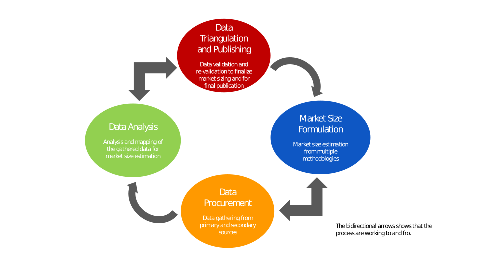
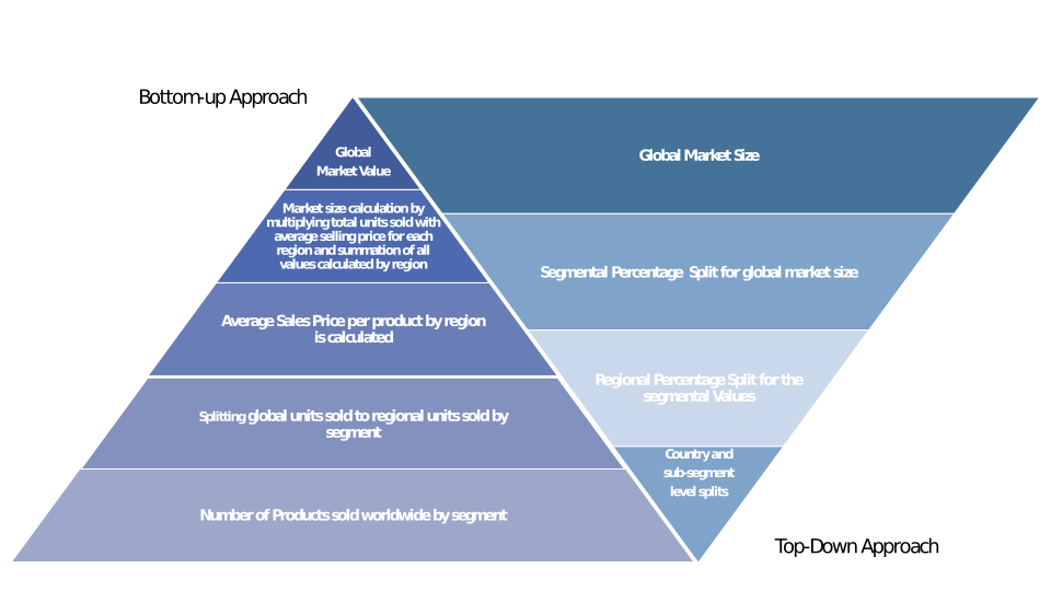
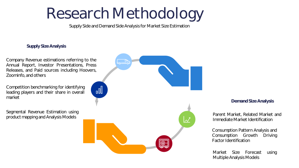
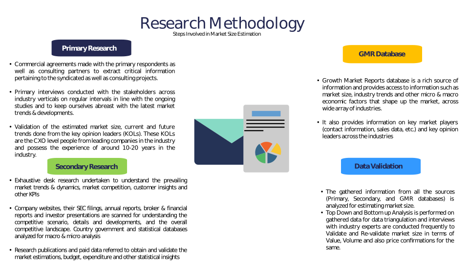
Chapter 3 Research Methodology
Chapter 4 Drone-Assisted Forest Moisture Content Mapping Market Overview
4.1 Introduction
4.1.1 Market Taxonomy
4.1.2 Market Definition
4.1.3 Macro-Economic Factors Impacting the Market Growth
4.2 Drone-Assisted Forest Moisture Content Mapping Market Dynamics
4.2.1 Market Drivers
4.2.2 Market Restraints
4.2.3 Market Opportunity
4.3 Drone-Assisted Forest Moisture Content Mapping Market - Supply Chain Analysis
4.3.1 List of Key Suppliers
4.3.2 List of Key Distributors
4.3.3 List of Key Consumers
4.4 Key Forces Shaping the Drone-Assisted Forest Moisture Content Mapping Market
4.4.1 Bargaining Power of Suppliers
4.4.2 Bargaining Power of Buyers
4.4.3 Threat of Substitution
4.4.4 Threat of New Entrants
4.4.5 Competitive Rivalry
4.5 Global Drone-Assisted Forest Moisture Content Mapping Market Size & Forecast, 2023-2032
4.5.1 Drone-Assisted Forest Moisture Content Mapping Market Size and Y-o-Y Growth
4.5.2 Drone-Assisted Forest Moisture Content Mapping Market Absolute $ Opportunity
Chapter 5 Global Drone-Assisted Forest Moisture Content Mapping Market Analysis and Forecast By Technology
5.1 Introduction
5.1.1 Key Market Trends & Growth Opportunities By Technology
5.1.2 Basis Point Share (BPS) Analysis By Technology
5.1.3 Absolute $ Opportunity Assessment By Technology
5.2 Drone-Assisted Forest Moisture Content Mapping Market Size Forecast By Technology
5.2.1 Multispectral Imaging
5.2.2 Thermal Imaging
5.2.3 LiDAR
5.2.4 RGB Imaging
5.2.5 Others
5.3 Market Attractiveness Analysis By Technology
Chapter 6 Global Drone-Assisted Forest Moisture Content Mapping Market Analysis and Forecast By Application
6.1 Introduction
6.1.1 Key Market Trends & Growth Opportunities By Application
6.1.2 Basis Point Share (BPS) Analysis By Application
6.1.3 Absolute $ Opportunity Assessment By Application
6.2 Drone-Assisted Forest Moisture Content Mapping Market Size Forecast By Application
6.2.1 Forest Health Monitoring
6.2.2 Fire Risk Assessment
6.2.3 Precision Forestry
6.2.4 Environmental Research
6.2.5 Others
6.3 Market Attractiveness Analysis By Application
Chapter 7 Global Drone-Assisted Forest Moisture Content Mapping Market Analysis and Forecast By End-User
7.1 Introduction
7.1.1 Key Market Trends & Growth Opportunities By End-User
7.1.2 Basis Point Share (BPS) Analysis By End-User
7.1.3 Absolute $ Opportunity Assessment By End-User
7.2 Drone-Assisted Forest Moisture Content Mapping Market Size Forecast By End-User
7.2.1 Government & Forestry Agencies
7.2.2 Environmental Organizations
7.2.3 Research Institutes
7.2.4 Commercial Forestry
7.2.5 Others
7.3 Market Attractiveness Analysis By End-User
Chapter 8 Global Drone-Assisted Forest Moisture Content Mapping Market Analysis and Forecast By Platform
8.1 Introduction
8.1.1 Key Market Trends & Growth Opportunities By Platform
8.1.2 Basis Point Share (BPS) Analysis By Platform
8.1.3 Absolute $ Opportunity Assessment By Platform
8.2 Drone-Assisted Forest Moisture Content Mapping Market Size Forecast By Platform
8.2.1 Fixed-Wing Drones
8.2.2 Rotary-Wing Drones
8.2.3 Hybrid Drones
8.3 Market Attractiveness Analysis By Platform
Chapter 9 Global Drone-Assisted Forest Moisture Content Mapping Market Analysis and Forecast by Region
9.1 Introduction
9.1.1 Key Market Trends & Growth Opportunities By Region
9.1.2 Basis Point Share (BPS) Analysis By Region
9.1.3 Absolute $ Opportunity Assessment By Region
9.2 Drone-Assisted Forest Moisture Content Mapping Market Size Forecast By Region
9.2.1 North America
9.2.2 Europe
9.2.3 Asia Pacific
9.2.4 Latin America
9.2.5 Middle East & Africa (MEA)
9.3 Market Attractiveness Analysis By Region
Chapter 10 Coronavirus Disease (COVID-19) Impact
10.1 Introduction
10.2 Current & Future Impact Analysis
10.3 Economic Impact Analysis
10.4 Government Policies
10.5 Investment Scenario
Chapter 11 North America Drone-Assisted Forest Moisture Content Mapping Analysis and Forecast
11.1 Introduction
11.2 North America Drone-Assisted Forest Moisture Content Mapping Market Size Forecast by Country
11.2.1 U.S.
11.2.2 Canada
11.3 Basis Point Share (BPS) Analysis by Country
11.4 Absolute $ Opportunity Assessment by Country
11.5 Market Attractiveness Analysis by Country
11.6 North America Drone-Assisted Forest Moisture Content Mapping Market Size Forecast By Technology
11.6.1 Multispectral Imaging
11.6.2 Thermal Imaging
11.6.3 LiDAR
11.6.4 RGB Imaging
11.6.5 Others
11.7 Basis Point Share (BPS) Analysis By Technology
11.8 Absolute $ Opportunity Assessment By Technology
11.9 Market Attractiveness Analysis By Technology
11.10 North America Drone-Assisted Forest Moisture Content Mapping Market Size Forecast By Application
11.10.1 Forest Health Monitoring
11.10.2 Fire Risk Assessment
11.10.3 Precision Forestry
11.10.4 Environmental Research
11.10.5 Others
11.11 Basis Point Share (BPS) Analysis By Application
11.12 Absolute $ Opportunity Assessment By Application
11.13 Market Attractiveness Analysis By Application
11.14 North America Drone-Assisted Forest Moisture Content Mapping Market Size Forecast By End-User
11.14.1 Government & Forestry Agencies
11.14.2 Environmental Organizations
11.14.3 Research Institutes
11.14.4 Commercial Forestry
11.14.5 Others
11.15 Basis Point Share (BPS) Analysis By End-User
11.16 Absolute $ Opportunity Assessment By End-User
11.17 Market Attractiveness Analysis By End-User
11.18 North America Drone-Assisted Forest Moisture Content Mapping Market Size Forecast By Platform
11.18.1 Fixed-Wing Drones
11.18.2 Rotary-Wing Drones
11.18.3 Hybrid Drones
11.19 Basis Point Share (BPS) Analysis By Platform
11.20 Absolute $ Opportunity Assessment By Platform
11.21 Market Attractiveness Analysis By Platform
Chapter 12 Europe Drone-Assisted Forest Moisture Content Mapping Analysis and Forecast
12.1 Introduction
12.2 Europe Drone-Assisted Forest Moisture Content Mapping Market Size Forecast by Country
12.2.1 Germany
12.2.2 France
12.2.3 Italy
12.2.4 U.K.
12.2.5 Spain
12.2.6 Russia
12.2.7 Rest of Europe
12.3 Basis Point Share (BPS) Analysis by Country
12.4 Absolute $ Opportunity Assessment by Country
12.5 Market Attractiveness Analysis by Country
12.6 Europe Drone-Assisted Forest Moisture Content Mapping Market Size Forecast By Technology
12.6.1 Multispectral Imaging
12.6.2 Thermal Imaging
12.6.3 LiDAR
12.6.4 RGB Imaging
12.6.5 Others
12.7 Basis Point Share (BPS) Analysis By Technology
12.8 Absolute $ Opportunity Assessment By Technology
12.9 Market Attractiveness Analysis By Technology
12.10 Europe Drone-Assisted Forest Moisture Content Mapping Market Size Forecast By Application
12.10.1 Forest Health Monitoring
12.10.2 Fire Risk Assessment
12.10.3 Precision Forestry
12.10.4 Environmental Research
12.10.5 Others
12.11 Basis Point Share (BPS) Analysis By Application
12.12 Absolute $ Opportunity Assessment By Application
12.13 Market Attractiveness Analysis By Application
12.14 Europe Drone-Assisted Forest Moisture Content Mapping Market Size Forecast By End-User
12.14.1 Government & Forestry Agencies
12.14.2 Environmental Organizations
12.14.3 Research Institutes
12.14.4 Commercial Forestry
12.14.5 Others
12.15 Basis Point Share (BPS) Analysis By End-User
12.16 Absolute $ Opportunity Assessment By End-User
12.17 Market Attractiveness Analysis By End-User
12.18 Europe Drone-Assisted Forest Moisture Content Mapping Market Size Forecast By Platform
12.18.1 Fixed-Wing Drones
12.18.2 Rotary-Wing Drones
12.18.3 Hybrid Drones
12.19 Basis Point Share (BPS) Analysis By Platform
12.20 Absolute $ Opportunity Assessment By Platform
12.21 Market Attractiveness Analysis By Platform
Chapter 13 Asia Pacific Drone-Assisted Forest Moisture Content Mapping Analysis and Forecast
13.1 Introduction
13.2 Asia Pacific Drone-Assisted Forest Moisture Content Mapping Market Size Forecast by Country
13.2.1 China
13.2.2 Japan
13.2.3 South Korea
13.2.4 India
13.2.5 Australia
13.2.6 South East Asia (SEA)
13.2.7 Rest of Asia Pacific (APAC)
13.3 Basis Point Share (BPS) Analysis by Country
13.4 Absolute $ Opportunity Assessment by Country
13.5 Market Attractiveness Analysis by Country
13.6 Asia Pacific Drone-Assisted Forest Moisture Content Mapping Market Size Forecast By Technology
13.6.1 Multispectral Imaging
13.6.2 Thermal Imaging
13.6.3 LiDAR
13.6.4 RGB Imaging
13.6.5 Others
13.7 Basis Point Share (BPS) Analysis By Technology
13.8 Absolute $ Opportunity Assessment By Technology
13.9 Market Attractiveness Analysis By Technology
13.10 Asia Pacific Drone-Assisted Forest Moisture Content Mapping Market Size Forecast By Application
13.10.1 Forest Health Monitoring
13.10.2 Fire Risk Assessment
13.10.3 Precision Forestry
13.10.4 Environmental Research
13.10.5 Others
13.11 Basis Point Share (BPS) Analysis By Application
13.12 Absolute $ Opportunity Assessment By Application
13.13 Market Attractiveness Analysis By Application
13.14 Asia Pacific Drone-Assisted Forest Moisture Content Mapping Market Size Forecast By End-User
13.14.1 Government & Forestry Agencies
13.14.2 Environmental Organizations
13.14.3 Research Institutes
13.14.4 Commercial Forestry
13.14.5 Others
13.15 Basis Point Share (BPS) Analysis By End-User
13.16 Absolute $ Opportunity Assessment By End-User
13.17 Market Attractiveness Analysis By End-User
13.18 Asia Pacific Drone-Assisted Forest Moisture Content Mapping Market Size Forecast By Platform
13.18.1 Fixed-Wing Drones
13.18.2 Rotary-Wing Drones
13.18.3 Hybrid Drones
13.19 Basis Point Share (BPS) Analysis By Platform
13.20 Absolute $ Opportunity Assessment By Platform
13.21 Market Attractiveness Analysis By Platform
Chapter 14 Latin America Drone-Assisted Forest Moisture Content Mapping Analysis and Forecast
14.1 Introduction
14.2 Latin America Drone-Assisted Forest Moisture Content Mapping Market Size Forecast by Country
14.2.1 Brazil
14.2.2 Mexico
14.2.3 Rest of Latin America (LATAM)
14.3 Basis Point Share (BPS) Analysis by Country
14.4 Absolute $ Opportunity Assessment by Country
14.5 Market Attractiveness Analysis by Country
14.6 Latin America Drone-Assisted Forest Moisture Content Mapping Market Size Forecast By Technology
14.6.1 Multispectral Imaging
14.6.2 Thermal Imaging
14.6.3 LiDAR
14.6.4 RGB Imaging
14.6.5 Others
14.7 Basis Point Share (BPS) Analysis By Technology
14.8 Absolute $ Opportunity Assessment By Technology
14.9 Market Attractiveness Analysis By Technology
14.10 Latin America Drone-Assisted Forest Moisture Content Mapping Market Size Forecast By Application
14.10.1 Forest Health Monitoring
14.10.2 Fire Risk Assessment
14.10.3 Precision Forestry
14.10.4 Environmental Research
14.10.5 Others
14.11 Basis Point Share (BPS) Analysis By Application
14.12 Absolute $ Opportunity Assessment By Application
14.13 Market Attractiveness Analysis By Application
14.14 Latin America Drone-Assisted Forest Moisture Content Mapping Market Size Forecast By End-User
14.14.1 Government & Forestry Agencies
14.14.2 Environmental Organizations
14.14.3 Research Institutes
14.14.4 Commercial Forestry
14.14.5 Others
14.15 Basis Point Share (BPS) Analysis By End-User
14.16 Absolute $ Opportunity Assessment By End-User
14.17 Market Attractiveness Analysis By End-User
14.18 Latin America Drone-Assisted Forest Moisture Content Mapping Market Size Forecast By Platform
14.18.1 Fixed-Wing Drones
14.18.2 Rotary-Wing Drones
14.18.3 Hybrid Drones
14.19 Basis Point Share (BPS) Analysis By Platform
14.20 Absolute $ Opportunity Assessment By Platform
14.21 Market Attractiveness Analysis By Platform
Chapter 15 Middle East & Africa (MEA) Drone-Assisted Forest Moisture Content Mapping Analysis and Forecast
15.1 Introduction
15.2 Middle East & Africa (MEA) Drone-Assisted Forest Moisture Content Mapping Market Size Forecast by Country
15.2.1 Saudi Arabia
15.2.2 South Africa
15.2.3 UAE
15.2.4 Rest of Middle East & Africa (MEA)
15.3 Basis Point Share (BPS) Analysis by Country
15.4 Absolute $ Opportunity Assessment by Country
15.5 Market Attractiveness Analysis by Country
15.6 Middle East & Africa (MEA) Drone-Assisted Forest Moisture Content Mapping Market Size Forecast By Technology
15.6.1 Multispectral Imaging
15.6.2 Thermal Imaging
15.6.3 LiDAR
15.6.4 RGB Imaging
15.6.5 Others
15.7 Basis Point Share (BPS) Analysis By Technology
15.8 Absolute $ Opportunity Assessment By Technology
15.9 Market Attractiveness Analysis By Technology
15.10 Middle East & Africa (MEA) Drone-Assisted Forest Moisture Content Mapping Market Size Forecast By Application
15.10.1 Forest Health Monitoring
15.10.2 Fire Risk Assessment
15.10.3 Precision Forestry
15.10.4 Environmental Research
15.10.5 Others
15.11 Basis Point Share (BPS) Analysis By Application
15.12 Absolute $ Opportunity Assessment By Application
15.13 Market Attractiveness Analysis By Application
15.14 Middle East & Africa (MEA) Drone-Assisted Forest Moisture Content Mapping Market Size Forecast By End-User
15.14.1 Government & Forestry Agencies
15.14.2 Environmental Organizations
15.14.3 Research Institutes
15.14.4 Commercial Forestry
15.14.5 Others
15.15 Basis Point Share (BPS) Analysis By End-User
15.16 Absolute $ Opportunity Assessment By End-User
15.17 Market Attractiveness Analysis By End-User
15.18 Middle East & Africa (MEA) Drone-Assisted Forest Moisture Content Mapping Market Size Forecast By Platform
15.18.1 Fixed-Wing Drones
15.18.2 Rotary-Wing Drones
15.18.3 Hybrid Drones
15.19 Basis Point Share (BPS) Analysis By Platform
15.20 Absolute $ Opportunity Assessment By Platform
15.21 Market Attractiveness Analysis By Platform
Chapter 16 Competition Landscape
16.1 Drone-Assisted Forest Moisture Content Mapping Market: Competitive Dashboard
16.2 Global Drone-Assisted Forest Moisture Content Mapping Market: Market Share Analysis, 2023
16.3 Company Profiles (Details – Overview, Financials, Developments, Strategy)
16.3.1 DJI Technology
16.3.2 Parrot Drones
16.3.3 AgEagle Aerial Systems
16.3.4 Delair
16.3.5 Teledyne FLIR
16.3.6 Trimble Inc.
16.3.7 Quantum Systems
16.3.8 MicaSense (a Parrot Company)
16.3.9 Sentera
16.3.10 DroneDeploy
16.3.11 RIEGL Laser Measurement Systems
16.3.12 Microdrones GmbH
16.3.13 Pix4D
16.3.14 Terra Drone Corporation
16.3.15 AeroVironment Inc.
16.3.16 YellowScan
16.3.17 senseFly
16.3.18 Wingtra AG
16.3.19 Skydio Inc.
16.3.20 Propeller Aero
Methodology
Related Reports
Some other reports from this category!


Our Clients