Aerial Survey Market Size, Share & Growth Analysis, 2025-2033
Aerial Survey Market Size, Share & Growth Analysis, 2025-2033
Segments - by Component (Hardware, Software, Services), by Platform (Fixed-Wing Aircraft, Rotary-Wing Aircraft, Unmanned Aerial Vehicles (UAVs)), by Application (Topographic Survey, Construction & Infrastructure, Agriculture & Forestry, Oil & Gas, Mining, Environmental Monitoring, Others), by End-User (Government, Commercial, Defense, Others)



Published : Aug, 2025
| Report ID :AD-141053
| 4.4 Rating
| 45 Reviews
| 283 Pages
| Format :


Aerial Survey Market: Key Numbers
The Aerial Survey market was valued at USD 4.1 Billion in 2024 and is projected to reach USD 10.9 Billion by 2033, a CAGR of 11.2%.
| Market size (2024) | USD 4.1 Billion |
|---|---|
| Forecast (2033) | USD 10.9 Billion |
| CAGR (2025-2033) | 11.2% |
| Largest region | North America |
| Segments covered | Component, Platform, Application, End-User |
| Key companies | Fugro, Quantum Spatial (NV5 Geospatial), Blom (Terratec AS), GeoSense, AeroMetric (now part of Quantum Spatial) |
Aerial Survey Market Size and Growth Outlook
Growth Market Reports finds that the global aerial survey market size in 2024 stands at USD 4.1 billion. The market is witnessing robust expansion, driven by technological advancements and increasing demand across various sectors. The aerial survey market is projected to grow at a CAGR of 11.2% from 2025 to 2033, reaching a forecasted value of USD 10.9 billion by 2033. Key growth factors include the integration of advanced sensors, the proliferation of unmanned aerial vehicles (UAVs), and the expanding applications in both commercial and government sectors.
A primary growth driver for the aerial survey market is the rapid advancement in sensor and imaging technologies. High-resolution cameras, LiDAR, multispectral, and hyperspectral sensors have significantly improved the accuracy and efficiency of aerial surveys, enabling detailed data collection over large and inaccessible areas. This technological evolution is particularly beneficial for sectors such as construction, agriculture, and environmental monitoring, where precise geospatial data is crucial for planning and decision-making. Additionally, the integration of artificial intelligence and machine learning in data processing has accelerated the extraction of actionable insights, further propelling market growth.
Another critical factor contributing to the expansion of the aerial survey market is the increasing adoption of UAVs. Unmanned aerial vehicles have revolutionized aerial data collection due to their cost-effectiveness, flexibility, and ability to access hazardous or remote locations. Industries such as mining, oil & gas, and infrastructure development are leveraging UAV-based aerial surveys for mapping, inspection, and monitoring purposes. The regulatory landscape is also evolving, with many countries streamlining drone regulations to facilitate commercial usage, thereby opening new avenues for market participants and driving overall market growth.
The growing need for efficient land management and urban planning is also fueling the demand for aerial surveys. Governments and municipal authorities are increasingly utilizing aerial survey data for topographic mapping, disaster management, and infrastructure development. The ability to rapidly acquire accurate geospatial data supports better resource allocation, risk assessment, and project execution. Furthermore, environmental monitoring applications, such as tracking deforestation, monitoring water bodies, and assessing the impact of climate change, are gaining prominence, contributing to the sustained growth of the aerial survey market.
From a regional perspective, North America currently dominates the aerial survey market, owing to the presence of advanced technology providers, robust regulatory frameworks, and significant investments in infrastructure and defense. However, the Asia Pacific region is expected to register the highest CAGR during the forecast period, driven by rapid urbanization, infrastructure development, and increasing adoption of UAV technology in countries such as China, India, and Japan. Europe also holds a substantial market share, supported by the region’s focus on environmental monitoring and renewable energy projects. The Middle East & Africa and Latin America are emerging markets, with growing opportunities in oil & gas, mining, and agriculture sectors.

Aerial Survey Market by Component
The aerial survey market by component is segmented into hardware, software, and services. The hardware segment encompasses a wide range of equipment, including high-resolution cameras, LiDAR sensors, GNSS receivers, and UAVs. This segment holds a significant share of the market, primarily due to continuous innovation and the increasing demand for sophisticated sensors that enhance data accuracy and operational efficiency. Hardware manufacturers are investing in miniaturization and integration of multiple sensors, enabling more compact and versatile aerial survey platforms. The proliferation of UAVs equipped with advanced hardware has further democratized access to aerial survey capabilities, enabling small and medium enterprises to leverage these technologies.
The software segment is witnessing rapid growth, driven by the need for advanced data processing, analytics, and visualization tools. Modern aerial survey software solutions offer automated workflows for image stitching, 3D mapping, orthophoto generation, and geospatial analysis. The integration of AI and machine learning algorithms has significantly improved the efficiency of data interpretation, allowing for real-time analysis and faster decision-making. Cloud-based platforms are gaining traction, offering scalability, collaboration, and seamless integration with other geospatial information systems (GIS). The increasing complexity and volume of data generated by aerial surveys necessitate robust software solutions, making this segment a critical driver of market growth.
Services constitute another vital component of the aerial survey market, encompassing data acquisition, processing, consulting, and maintenance. Many organizations prefer to outsource aerial survey operations to specialized service providers, especially when lacking in-house expertise or equipment. Service providers offer end-to-end solutions, from flight planning and data capture to post-processing and analysis, catering to a wide array of industries. The trend towards managed services is gaining momentum, as clients seek to focus on core operations while leveraging the technical expertise and advanced equipment of professional aerial survey firms. This segment is expected to grow steadily, supported by the increasing complexity of projects and the need for high-quality, actionable data.
The interplay between hardware, software, and services is crucial for the overall performance and value proposition of aerial survey solutions. Market players are increasingly offering integrated solutions that combine state-of-the-art hardware, powerful analytics software, and comprehensive services, delivering maximum value to end-users. The emphasis on interoperability and seamless data flow across components is driving innovation and fostering collaboration among hardware manufacturers, software developers, and service providers. As the market matures, the demand for holistic solutions that address the entire aerial survey workflow is expected to rise, further boosting the growth of all three components.
Aerial Survey Market Report Scope
| Attributes | Details |
| Report Title | Aerial Survey Market Research Report 2033 |
| By Component | Hardware, Software, Services |
| By Platform | Fixed-Wing Aircraft, Rotary-Wing Aircraft, Unmanned Aerial Vehicles (UAVs) |
| By Application | Topographic Survey, Construction & Infrastructure, Agriculture & Forestry, Oil & Gas, Mining, Environmental Monitoring, Others |
| By End-User | Government, Commercial, Defense, Others |
| Regions Covered | North America, Europe, APAC, Latin America, MEA |
| Countries Covered | North America (United States, Canada), Europe (Germany, France, Italy, United Kingdom, Spain, Russia, Rest of Europe), Asia Pacific (China, Japan, South Korea, India, Australia, South East Asia (SEA), Rest of Asia Pacific), Latin America (Mexico, Brazil, Rest of Latin America), Middle East & Africa (Saudi Arabia, South Africa, United Arab Emirates, Rest of Middle East & Africa) |
| Base Year | 2024 |
| Historic Data | 2018-2023 |
| Forecast Period | 2025-2033 |
| Number of Pages | 283 |
| Number of Tables & Figures | 374 |
| Customization Available | Yes, the report can be customized as per your need. |
Aerial Survey Market by Platform
The platform segment of the aerial survey market is categorized into fixed-wing aircraft, rotary-wing aircraft, and unmanned aerial vehicles (UAVs). Fixed-wing aircraft have traditionally been the workhorse of large-scale aerial surveys, offering extended flight endurance, high payload capacity, and the ability to cover vast areas efficiently. These platforms are particularly suited for topographic mapping, corridor mapping, and resource exploration projects that require high-altitude and long-duration flights. The integration of advanced sensors and real-time data transmission capabilities has enhanced the utility of fixed-wing platforms, making them indispensable for large-scale and high-precision aerial surveys.
Rotary-wing aircraft, including helicopters, offer unique advantages in terms of maneuverability, vertical takeoff and landing, and the ability to hover over specific locations. These capabilities make rotary-wing platforms ideal for applications that require detailed inspection, low-altitude data collection, and access to confined or rugged terrains. Industries such as oil & gas, utilities, and emergency response frequently rely on rotary-wing aerial surveys for infrastructure inspection, asset monitoring, and disaster assessment. The versatility and adaptability of rotary-wing platforms ensure their continued relevance in the evolving aerial survey market, especially for specialized and high-risk missions.
Unmanned aerial vehicles (UAVs) represent the most dynamic and rapidly growing segment within the aerial survey market. UAVs, commonly known as drones, have revolutionized the industry by offering cost-effective, flexible, and scalable solutions for a wide range of applications. The ability to deploy UAVs quickly, access hazardous or inaccessible areas, and capture high-resolution data has democratized aerial surveying, enabling organizations of all sizes to benefit from geospatial intelligence. Advances in battery technology, autonomous flight systems, and payload integration have further expanded the capabilities of UAVs, making them the platform of choice for many commercial and government applications.
The choice of platform is often dictated by the specific requirements of the survey mission, such as area coverage, resolution, payload capacity, and operational environment. Market players are increasingly offering hybrid solutions that combine the strengths of different platforms, optimizing performance and cost-effectiveness. The ongoing evolution of platform technologies, coupled with regulatory advancements and increasing user awareness, is expected to drive sustained growth across all platform segments. As the aerial survey market continues to expand, the demand for innovative and versatile platforms will remain a key determinant of competitive advantage.
Aerial Survey Market by Application
The aerial survey market finds application across a diverse range of industries, including topographic survey, construction & infrastructure, agriculture & forestry, oil & gas, mining, environmental monitoring, and others. Topographic surveys remain a cornerstone application, providing accurate elevation data, terrain models, and land use information essential for urban planning, infrastructure development, and resource management. The ability to rapidly acquire high-resolution topographic data over large areas has transformed the planning and execution of large-scale projects, reducing costs and improving decision-making accuracy.
In the construction and infrastructure sector, aerial surveys play a critical role in site selection, progress monitoring, volumetric analysis, and quality control. The integration of aerial data with building information modeling (BIM) and geographic information systems (GIS) has enabled more efficient project management, risk assessment, and resource allocation. Construction companies are increasingly adopting aerial survey solutions to enhance productivity, ensure compliance with regulatory standards, and mitigate project delays. The growing emphasis on smart cities and sustainable infrastructure is expected to further drive the adoption of aerial surveys in this sector.
Agriculture and forestry represent another significant application area for aerial surveys, with farmers and land managers leveraging geospatial data for precision agriculture, crop monitoring, yield estimation, and forest inventory management. The use of multispectral and hyperspectral sensors enables the detection of crop health, soil moisture levels, and pest infestations, facilitating timely interventions and optimizing resource utilization. In forestry, aerial surveys support sustainable management practices, biodiversity assessment, and wildfire monitoring, contributing to environmental conservation and resource optimization.
The oil & gas and mining industries rely heavily on aerial surveys for exploration, asset management, and environmental compliance. Aerial data supports the identification of geological features, monitoring of pipeline corridors, and assessment of environmental impact, enhancing operational efficiency and safety. Environmental monitoring applications, such as tracking deforestation, monitoring water bodies, and assessing the impact of climate change, are gaining prominence, driven by the need for sustainable resource management and regulatory compliance. The versatility of aerial survey solutions ensures their continued relevance across a broad spectrum of applications, supporting the evolving needs of diverse industries.
Aerial Survey Market by End-User
The aerial survey market serves a diverse array of end-users, including government, commercial, defense, and others. Government agencies are among the largest adopters of aerial survey technologies, utilizing geospatial data for urban planning, disaster management, infrastructure development, and environmental monitoring. The ability to rapidly acquire and analyze aerial data supports informed decision-making, efficient resource allocation, and effective policy implementation. Governments are also investing in the modernization of cadastral mapping, land administration, and public asset management, driving the adoption of advanced aerial survey solutions.
Commercial enterprises represent a rapidly growing segment within the aerial survey market, encompassing industries such as construction, agriculture, mining, oil & gas, and utilities. These organizations leverage aerial surveys to enhance operational efficiency, reduce costs, and improve project outcomes. The increasing availability of cost-effective UAV-based solutions has enabled small and medium enterprises to access high-quality geospatial data, leveling the playing field and fostering innovation. Commercial end-users are also driving demand for integrated solutions that combine hardware, software, and services, enabling seamless data acquisition, processing, and analysis.
The defense sector has long been a major user of aerial survey technologies, employing them for reconnaissance, surveillance, intelligence gathering, and mission planning. Advances in sensor technology, real-time data transmission, and autonomous flight systems have enhanced the capabilities of aerial survey platforms, enabling defense agencies to operate in complex and dynamic environments. The growing focus on border security, counter-terrorism, and disaster response is expected to sustain demand for advanced aerial survey solutions within the defense sector.
Other end-users, such as research institutions, environmental organizations, and non-governmental organizations, are also increasingly leveraging aerial survey technologies for scientific research, conservation, and humanitarian applications. The versatility and adaptability of aerial survey solutions enable their deployment across a wide range of use cases, supporting the evolving needs of diverse stakeholders. As awareness of the benefits of aerial surveys continues to grow, the market is expected to witness increased adoption across all end-user segments.
Aerial Survey Market Opportunities and Threats
The aerial survey market presents numerous opportunities for growth and innovation, driven by the rapid advancement of sensor technologies, the proliferation of UAVs, and the expanding range of applications. One significant opportunity lies in the integration of artificial intelligence and machine learning with aerial survey data, enabling real-time analysis, predictive modeling, and automated decision-making. This capability is particularly valuable for applications such as disaster response, precision agriculture, and infrastructure monitoring, where timely and accurate insights can drive better outcomes. Additionally, the increasing adoption of cloud-based platforms offers opportunities for scalability, collaboration, and seamless data sharing, further enhancing the value proposition of aerial survey solutions.
Another promising opportunity is the expansion of aerial survey applications into emerging markets, such as smart cities, renewable energy, and environmental conservation. The growing focus on sustainable development, climate change mitigation, and resource optimization is driving demand for high-quality geospatial data, creating new avenues for market participants. The development of hybrid and autonomous aerial survey platforms, capable of operating in challenging environments and integrating multiple sensors, also presents significant growth potential. Partnerships between technology providers, service companies, and end-users are expected to accelerate innovation and facilitate the adoption of next-generation aerial survey solutions.
Despite the numerous opportunities, the aerial survey market faces certain restraining factors, chief among them being regulatory challenges and privacy concerns. The operation of UAVs and other aerial survey platforms is subject to stringent regulations in many countries, covering aspects such as airspace management, flight permissions, and data privacy. Compliance with these regulations can be complex and time-consuming, particularly for cross-border operations and large-scale projects. Additionally, concerns related to data security, unauthorized surveillance, and misuse of aerial imagery may hinder market growth, necessitating the development of robust regulatory frameworks and industry best practices to address these challenges.
Aerial Survey Market Size by Region
North America leads the aerial survey market, accounting for approximately USD 1.5 billion in market share in 2024. The region benefits from a mature technological ecosystem, a high concentration of industry players, and substantial investments in infrastructure and defense. The United States, in particular, has been at the forefront of adopting advanced aerial survey solutions, supported by favorable regulatory frameworks and a strong focus on innovation. The presence of leading technology providers and service companies has further consolidated North America’s position as a key market for aerial surveys.
The Asia Pacific region is poised for the fastest growth, with a projected CAGR of 13.5% from 2025 to 2033. The market size in Asia Pacific is estimated at USD 1.1 billion in 2024, driven by rapid urbanization, infrastructure development, and increasing adoption of UAV technology in countries such as China, India, and Japan. Government initiatives aimed at modernizing land administration, improving disaster management, and supporting smart city projects are fueling demand for aerial survey solutions. The expanding presence of local and international technology providers is also contributing to market growth, making Asia Pacific a strategic focus for market participants.
Europe holds a substantial share of the aerial survey market, with a market size of USD 0.9 billion in 2024. The region’s emphasis on environmental monitoring, renewable energy, and sustainable development has driven the adoption of aerial survey technologies across a wide range of applications. Countries such as Germany, France, and the United Kingdom are leading the way in integrating aerial surveys into infrastructure planning, forestry management, and environmental conservation efforts. The Middle East & Africa and Latin America are emerging markets, with a combined market size of USD 0.6 billion in 2024. These regions offer significant growth potential, particularly in sectors such as oil & gas, mining, and agriculture, as governments and private enterprises increasingly recognize the value of geospatial intelligence.

Aerial Survey Market Competitive Landscape
The aerial survey market is characterized by a highly competitive landscape, with a mix of established players and innovative startups vying for market share. Leading companies are focusing on product innovation, strategic partnerships, and geographic expansion to strengthen their market position. The integration of advanced sensor technologies, AI-driven analytics, and cloud-based platforms has become a key differentiator, enabling companies to offer comprehensive and value-added solutions to their clients. The market is also witnessing increased consolidation, with mergers and acquisitions aimed at enhancing technological capabilities and expanding service portfolios.
Collaboration between hardware manufacturers, software developers, and service providers is becoming increasingly important, as end-users demand integrated and end-to-end aerial survey solutions. Companies are investing in research and development to stay ahead of technological trends, such as autonomous flight, real-time data processing, and hybrid platform development. The ability to deliver customized solutions that address the specific needs of different industries and applications is emerging as a critical success factor in the competitive landscape. Market leaders are also leveraging their global presence and extensive networks to capitalize on emerging opportunities in high-growth regions such as Asia Pacific and the Middle East.
Some of the major companies operating in the aerial survey market include Hexagon AB, Fugro N.V., Quantum Spatial (NV5 Geospatial), Blom ASA, 3D Laser Mapping, GeoSLAM, Woolpert, Inc., Landpoint, LLC, Cooper Aerial Surveys Co., and Nearmap Ltd.. These companies offer a wide range of products and services, catering to diverse industries and applications. Hexagon AB, for instance, is renowned for its advanced geospatial solutions, integrating hardware, software, and services to deliver high-precision aerial survey data. Fugro N.V. specializes in geotechnical, survey, and geospatial services, with a strong focus on innovation and sustainability.
Quantum Spatial, a part of NV5 Geospatial, is a leading provider of geospatial data acquisition, processing, and analytics services, serving clients across government, infrastructure, and environmental sectors. Blom ASA and 3D Laser Mapping are known for their expertise in LiDAR and photogrammetry, offering cutting-edge solutions for topographic mapping, forestry, and urban planning. GeoSLAM and Woolpert, Inc. are at the forefront of integrating mobile mapping and aerial survey technologies, enabling rapid data capture and real-time analytics. Landpoint, LLC and Cooper Aerial Surveys Co. provide specialized aerial survey services for oil & gas, construction, and environmental monitoring projects, while Nearmap Ltd. is recognized for its high-resolution aerial imagery and cloud-based geospatial platforms.
The competitive dynamics of the aerial survey market are shaped by ongoing technological advancements, evolving customer needs, and regulatory developments. Companies that can anticipate market trends, invest in innovation, and build strong partnerships will be well-positioned to capitalize on the growing demand for aerial survey solutions. As the market continues to evolve, the emphasis on quality, reliability, and customer-centricity will remain paramount, driving sustained growth and value creation for both market participants and end-users.
Top Companies in the Aerial Survey Market
- Fugro
- Quantum Spatial (NV5 Geospatial)
- Blom (Terratec AS)
- GeoSense
- AeroMetric (now part of Quantum Spatial)
- Landpoint
- PASCO Corporation
- Kucera International
- AAM Group (WSP)
- 3D Laser Mapping (GeoSLAM)
- Cyient
- Surdex Corporation
- RIEGL Laser Measurement Systems
- Teledyne Optech
- Leica Geosystems (Hexagon AB)
- Woolpert
- Trimble Inc.
- DroneDeploy
- PrecisionHawk
- Nearmap

Segments
The Aerial Survey market has been segmented on the basis of
Component
- Hardware
- Software
- Services
Platform
- Fixed-Wing Aircraft
- Rotary-Wing Aircraft
- Unmanned Aerial Vehicles (UAVs)
Application
- Topographic Survey
- Construction & Infrastructure
- Agriculture & Forestry
- Oil & Gas
- Mining
- Environmental Monitoring
- Others
End-User
- Government
- Commercial
- Defense
- Others
Frequently Asked Questions
Notable companies include Hexagon AB, Fugro N.V., Quantum Spatial (NV5 Geospatial), Blom ASA, 3D Laser Mapping, GeoSLAM, Woolpert, Inc., Landpoint, LLC, Cooper Aerial Surveys Co., and Nearmap Ltd.
Key challenges include regulatory hurdles, privacy concerns, data security issues, and the complexity of complying with airspace and data management regulations.
Major end-users include government agencies, commercial enterprises (construction, agriculture, mining, oil & gas), defense organizations, and research or environmental institutions.
UAVs have revolutionized aerial surveying by offering cost-effective, flexible, and scalable solutions. They enable rapid data collection in hazardous or inaccessible areas and are increasingly used across industries due to regulatory support and technological advancements.
The aerial survey market is segmented into hardware (cameras, LiDAR, GNSS, UAVs), software (data processing, analytics, visualization), and services (data acquisition, processing, consulting, maintenance).
North America currently leads the market, while Asia Pacific is expected to register the highest CAGR. Europe also holds a significant share, and the Middle East & Africa and Latin America are emerging markets.
Aerial surveys are widely used for topographic mapping, construction and infrastructure monitoring, agriculture and forestry management, oil & gas exploration, mining, and environmental monitoring.
Key technologies driving growth include advanced sensors (such as LiDAR, multispectral, and hyperspectral), high-resolution cameras, unmanned aerial vehicles (UAVs), artificial intelligence, and machine learning for data processing.
The aerial survey market is expected to grow at a CAGR of 11.2% from 2025 to 2033.
The global aerial survey market size in 2024 is estimated at USD 4.1 billion.
Table Of Content
Chapter 1 Executive SummaryChapter 2 Assumptions and Acronyms Used
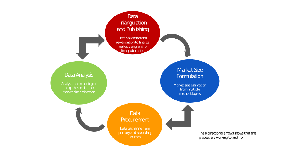
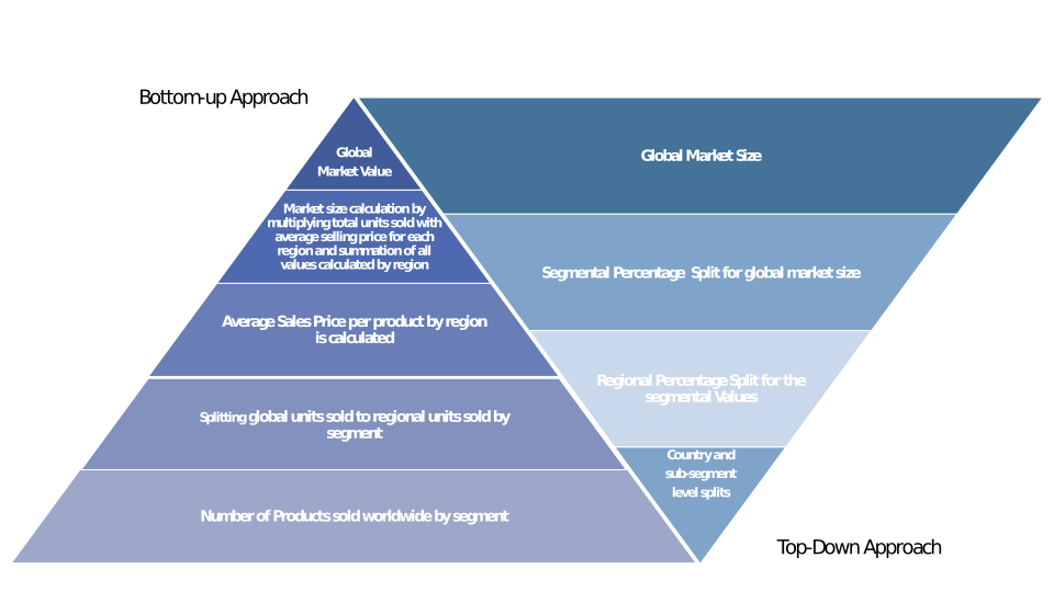
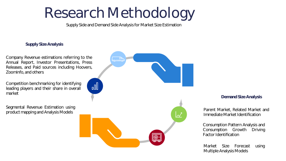
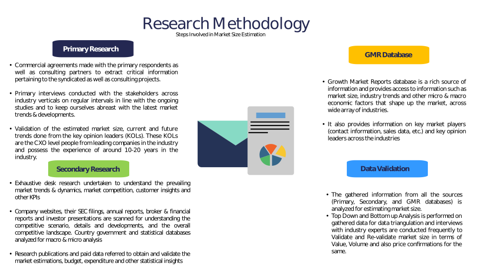
Chapter 3 Research Methodology
Chapter 4 Aerial Survey Market Overview
4.1 Introduction
4.1.1 Market Taxonomy
4.1.2 Market Definition
4.1.3 Macro-Economic Factors Impacting the Market Growth
4.2 Aerial Survey Market Dynamics
4.2.1 Market Drivers
4.2.2 Market Restraints
4.2.3 Market Opportunity
4.3 Aerial Survey Market - Supply Chain Analysis
4.3.1 List of Key Suppliers
4.3.2 List of Key Distributors
4.3.3 List of Key Consumers
4.4 Key Forces Shaping the Aerial Survey Market
4.4.1 Bargaining Power of Suppliers
4.4.2 Bargaining Power of Buyers
4.4.3 Threat of Substitution
4.4.4 Threat of New Entrants
4.4.5 Competitive Rivalry
4.5 Global Aerial Survey Market Size & Forecast, 2023-2032
4.5.1 Aerial Survey Market Size and Y-o-Y Growth
4.5.2 Aerial Survey Market Absolute $ Opportunity
Chapter 5 Global Aerial Survey Market Analysis and Forecast By Component
5.1 Introduction
5.1.1 Key Market Trends & Growth Opportunities By Component
5.1.2 Basis Point Share (BPS) Analysis By Component
5.1.3 Absolute $ Opportunity Assessment By Component
5.2 Aerial Survey Market Size Forecast By Component
5.2.1 Hardware
5.2.2 Software
5.2.3 Services
5.3 Market Attractiveness Analysis By Component
Chapter 6 Global Aerial Survey Market Analysis and Forecast By Platform
6.1 Introduction
6.1.1 Key Market Trends & Growth Opportunities By Platform
6.1.2 Basis Point Share (BPS) Analysis By Platform
6.1.3 Absolute $ Opportunity Assessment By Platform
6.2 Aerial Survey Market Size Forecast By Platform
6.2.1 Fixed-Wing Aircraft
6.2.2 Rotary-Wing Aircraft
6.2.3 Unmanned Aerial Vehicles (UAVs)
6.3 Market Attractiveness Analysis By Platform
Chapter 7 Global Aerial Survey Market Analysis and Forecast By Application
7.1 Introduction
7.1.1 Key Market Trends & Growth Opportunities By Application
7.1.2 Basis Point Share (BPS) Analysis By Application
7.1.3 Absolute $ Opportunity Assessment By Application
7.2 Aerial Survey Market Size Forecast By Application
7.2.1 Topographic Survey
7.2.2 Construction & Infrastructure
7.2.3 Agriculture & Forestry
7.2.4 Oil & Gas
7.2.5 Mining
7.2.6 Environmental Monitoring
7.2.7 Others
7.3 Market Attractiveness Analysis By Application
Chapter 8 Global Aerial Survey Market Analysis and Forecast By End-User
8.1 Introduction
8.1.1 Key Market Trends & Growth Opportunities By End-User
8.1.2 Basis Point Share (BPS) Analysis By End-User
8.1.3 Absolute $ Opportunity Assessment By End-User
8.2 Aerial Survey Market Size Forecast By End-User
8.2.1 Government
8.2.2 Commercial
8.2.3 Defense
8.2.4 Others
8.3 Market Attractiveness Analysis By End-User
Chapter 9 Global Aerial Survey Market Analysis and Forecast by Region
9.1 Introduction
9.1.1 Key Market Trends & Growth Opportunities By Region
9.1.2 Basis Point Share (BPS) Analysis By Region
9.1.3 Absolute $ Opportunity Assessment By Region
9.2 Aerial Survey Market Size Forecast By Region
9.2.1 North America
9.2.2 Europe
9.2.3 Asia Pacific
9.2.4 Latin America
9.2.5 Middle East & Africa (MEA)
9.3 Market Attractiveness Analysis By Region
Chapter 10 Coronavirus Disease (COVID-19) Impact
10.1 Introduction
10.2 Current & Future Impact Analysis
10.3 Economic Impact Analysis
10.4 Government Policies
10.5 Investment Scenario
Chapter 11 North America Aerial Survey Analysis and Forecast
11.1 Introduction
11.2 North America Aerial Survey Market Size Forecast by Country
11.2.1 U.S.
11.2.2 Canada
11.3 Basis Point Share (BPS) Analysis by Country
11.4 Absolute $ Opportunity Assessment by Country
11.5 Market Attractiveness Analysis by Country
11.6 North America Aerial Survey Market Size Forecast By Component
11.6.1 Hardware
11.6.2 Software
11.6.3 Services
11.7 Basis Point Share (BPS) Analysis By Component
11.8 Absolute $ Opportunity Assessment By Component
11.9 Market Attractiveness Analysis By Component
11.10 North America Aerial Survey Market Size Forecast By Platform
11.10.1 Fixed-Wing Aircraft
11.10.2 Rotary-Wing Aircraft
11.10.3 Unmanned Aerial Vehicles (UAVs)
11.11 Basis Point Share (BPS) Analysis By Platform
11.12 Absolute $ Opportunity Assessment By Platform
11.13 Market Attractiveness Analysis By Platform
11.14 North America Aerial Survey Market Size Forecast By Application
11.14.1 Topographic Survey
11.14.2 Construction & Infrastructure
11.14.3 Agriculture & Forestry
11.14.4 Oil & Gas
11.14.5 Mining
11.14.6 Environmental Monitoring
11.14.7 Others
11.15 Basis Point Share (BPS) Analysis By Application
11.16 Absolute $ Opportunity Assessment By Application
11.17 Market Attractiveness Analysis By Application
11.18 North America Aerial Survey Market Size Forecast By End-User
11.18.1 Government
11.18.2 Commercial
11.18.3 Defense
11.18.4 Others
11.19 Basis Point Share (BPS) Analysis By End-User
11.20 Absolute $ Opportunity Assessment By End-User
11.21 Market Attractiveness Analysis By End-User
Chapter 12 Europe Aerial Survey Analysis and Forecast
12.1 Introduction
12.2 Europe Aerial Survey Market Size Forecast by Country
12.2.1 Germany
12.2.2 France
12.2.3 Italy
12.2.4 U.K.
12.2.5 Spain
12.2.6 Russia
12.2.7 Rest of Europe
12.3 Basis Point Share (BPS) Analysis by Country
12.4 Absolute $ Opportunity Assessment by Country
12.5 Market Attractiveness Analysis by Country
12.6 Europe Aerial Survey Market Size Forecast By Component
12.6.1 Hardware
12.6.2 Software
12.6.3 Services
12.7 Basis Point Share (BPS) Analysis By Component
12.8 Absolute $ Opportunity Assessment By Component
12.9 Market Attractiveness Analysis By Component
12.10 Europe Aerial Survey Market Size Forecast By Platform
12.10.1 Fixed-Wing Aircraft
12.10.2 Rotary-Wing Aircraft
12.10.3 Unmanned Aerial Vehicles (UAVs)
12.11 Basis Point Share (BPS) Analysis By Platform
12.12 Absolute $ Opportunity Assessment By Platform
12.13 Market Attractiveness Analysis By Platform
12.14 Europe Aerial Survey Market Size Forecast By Application
12.14.1 Topographic Survey
12.14.2 Construction & Infrastructure
12.14.3 Agriculture & Forestry
12.14.4 Oil & Gas
12.14.5 Mining
12.14.6 Environmental Monitoring
12.14.7 Others
12.15 Basis Point Share (BPS) Analysis By Application
12.16 Absolute $ Opportunity Assessment By Application
12.17 Market Attractiveness Analysis By Application
12.18 Europe Aerial Survey Market Size Forecast By End-User
12.18.1 Government
12.18.2 Commercial
12.18.3 Defense
12.18.4 Others
12.19 Basis Point Share (BPS) Analysis By End-User
12.20 Absolute $ Opportunity Assessment By End-User
12.21 Market Attractiveness Analysis By End-User
Chapter 13 Asia Pacific Aerial Survey Analysis and Forecast
13.1 Introduction
13.2 Asia Pacific Aerial Survey Market Size Forecast by Country
13.2.1 China
13.2.2 Japan
13.2.3 South Korea
13.2.4 India
13.2.5 Australia
13.2.6 South East Asia (SEA)
13.2.7 Rest of Asia Pacific (APAC)
13.3 Basis Point Share (BPS) Analysis by Country
13.4 Absolute $ Opportunity Assessment by Country
13.5 Market Attractiveness Analysis by Country
13.6 Asia Pacific Aerial Survey Market Size Forecast By Component
13.6.1 Hardware
13.6.2 Software
13.6.3 Services
13.7 Basis Point Share (BPS) Analysis By Component
13.8 Absolute $ Opportunity Assessment By Component
13.9 Market Attractiveness Analysis By Component
13.10 Asia Pacific Aerial Survey Market Size Forecast By Platform
13.10.1 Fixed-Wing Aircraft
13.10.2 Rotary-Wing Aircraft
13.10.3 Unmanned Aerial Vehicles (UAVs)
13.11 Basis Point Share (BPS) Analysis By Platform
13.12 Absolute $ Opportunity Assessment By Platform
13.13 Market Attractiveness Analysis By Platform
13.14 Asia Pacific Aerial Survey Market Size Forecast By Application
13.14.1 Topographic Survey
13.14.2 Construction & Infrastructure
13.14.3 Agriculture & Forestry
13.14.4 Oil & Gas
13.14.5 Mining
13.14.6 Environmental Monitoring
13.14.7 Others
13.15 Basis Point Share (BPS) Analysis By Application
13.16 Absolute $ Opportunity Assessment By Application
13.17 Market Attractiveness Analysis By Application
13.18 Asia Pacific Aerial Survey Market Size Forecast By End-User
13.18.1 Government
13.18.2 Commercial
13.18.3 Defense
13.18.4 Others
13.19 Basis Point Share (BPS) Analysis By End-User
13.20 Absolute $ Opportunity Assessment By End-User
13.21 Market Attractiveness Analysis By End-User
Chapter 14 Latin America Aerial Survey Analysis and Forecast
14.1 Introduction
14.2 Latin America Aerial Survey Market Size Forecast by Country
14.2.1 Brazil
14.2.2 Mexico
14.2.3 Rest of Latin America (LATAM)
14.3 Basis Point Share (BPS) Analysis by Country
14.4 Absolute $ Opportunity Assessment by Country
14.5 Market Attractiveness Analysis by Country
14.6 Latin America Aerial Survey Market Size Forecast By Component
14.6.1 Hardware
14.6.2 Software
14.6.3 Services
14.7 Basis Point Share (BPS) Analysis By Component
14.8 Absolute $ Opportunity Assessment By Component
14.9 Market Attractiveness Analysis By Component
14.10 Latin America Aerial Survey Market Size Forecast By Platform
14.10.1 Fixed-Wing Aircraft
14.10.2 Rotary-Wing Aircraft
14.10.3 Unmanned Aerial Vehicles (UAVs)
14.11 Basis Point Share (BPS) Analysis By Platform
14.12 Absolute $ Opportunity Assessment By Platform
14.13 Market Attractiveness Analysis By Platform
14.14 Latin America Aerial Survey Market Size Forecast By Application
14.14.1 Topographic Survey
14.14.2 Construction & Infrastructure
14.14.3 Agriculture & Forestry
14.14.4 Oil & Gas
14.14.5 Mining
14.14.6 Environmental Monitoring
14.14.7 Others
14.15 Basis Point Share (BPS) Analysis By Application
14.16 Absolute $ Opportunity Assessment By Application
14.17 Market Attractiveness Analysis By Application
14.18 Latin America Aerial Survey Market Size Forecast By End-User
14.18.1 Government
14.18.2 Commercial
14.18.3 Defense
14.18.4 Others
14.19 Basis Point Share (BPS) Analysis By End-User
14.20 Absolute $ Opportunity Assessment By End-User
14.21 Market Attractiveness Analysis By End-User
Chapter 15 Middle East & Africa (MEA) Aerial Survey Analysis and Forecast
15.1 Introduction
15.2 Middle East & Africa (MEA) Aerial Survey Market Size Forecast by Country
15.2.1 Saudi Arabia
15.2.2 South Africa
15.2.3 UAE
15.2.4 Rest of Middle East & Africa (MEA)
15.3 Basis Point Share (BPS) Analysis by Country
15.4 Absolute $ Opportunity Assessment by Country
15.5 Market Attractiveness Analysis by Country
15.6 Middle East & Africa (MEA) Aerial Survey Market Size Forecast By Component
15.6.1 Hardware
15.6.2 Software
15.6.3 Services
15.7 Basis Point Share (BPS) Analysis By Component
15.8 Absolute $ Opportunity Assessment By Component
15.9 Market Attractiveness Analysis By Component
15.10 Middle East & Africa (MEA) Aerial Survey Market Size Forecast By Platform
15.10.1 Fixed-Wing Aircraft
15.10.2 Rotary-Wing Aircraft
15.10.3 Unmanned Aerial Vehicles (UAVs)
15.11 Basis Point Share (BPS) Analysis By Platform
15.12 Absolute $ Opportunity Assessment By Platform
15.13 Market Attractiveness Analysis By Platform
15.14 Middle East & Africa (MEA) Aerial Survey Market Size Forecast By Application
15.14.1 Topographic Survey
15.14.2 Construction & Infrastructure
15.14.3 Agriculture & Forestry
15.14.4 Oil & Gas
15.14.5 Mining
15.14.6 Environmental Monitoring
15.14.7 Others
15.15 Basis Point Share (BPS) Analysis By Application
15.16 Absolute $ Opportunity Assessment By Application
15.17 Market Attractiveness Analysis By Application
15.18 Middle East & Africa (MEA) Aerial Survey Market Size Forecast By End-User
15.18.1 Government
15.18.2 Commercial
15.18.3 Defense
15.18.4 Others
15.19 Basis Point Share (BPS) Analysis By End-User
15.20 Absolute $ Opportunity Assessment By End-User
15.21 Market Attractiveness Analysis By End-User
Chapter 16 Competition Landscape
16.1 Aerial Survey Market: Competitive Dashboard
16.2 Global Aerial Survey Market: Market Share Analysis, 2023
16.3 Company Profiles (Details – Overview, Financials, Developments, Strategy)
16.3.1 Fugro
16.3.2 Quantum Spatial (NV5 Geospatial)
16.3.3 Blom (Terratec AS)
16.3.4 GeoSense
16.3.5 AeroMetric (now part of Quantum Spatial)
16.3.6 Landpoint
16.3.7 PASCO Corporation
16.3.8 Kucera International
16.3.9 AAM Group (WSP)
16.3.10 3D Laser Mapping (GeoSLAM)
16.3.11 Cyient
16.3.12 Surdex Corporation
16.3.13 RIEGL Laser Measurement Systems
16.3.14 Teledyne Optech
16.3.15 Leica Geosystems (Hexagon AB)
16.3.16 Woolpert
16.3.17 Trimble Inc.
16.3.18 DroneDeploy
16.3.19 PrecisionHawk
16.3.20 Nearmap
Methodology
Related Reports
Some other reports from this category!


Our Clients